By Marion Halliday, Adelaide, South Australia
Marion is “Red Nomad OZ”, author, blogger and Aussie traveller who loves discovering nature-based attractions and activities – and scenic loos – all over Australia. Her Aussie travel blog and published book “Aussie Loos with Views” provide inspiration for other Aussie explorers.
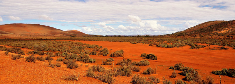
GAWLER RANGES, SOUTH AUSTRALIA – Rain, Rocky Roads and Rhyolites.
After a five-year-long dry spell, it rained the night before our trek to Outback South Australia’s Gawler Ranges. Quite a lot, by Outback standards!
A bit of rain isn’t necessarily a problem when you’re travelling downunder. Unless your destination is only accessible via a 128 km (80 mi) stretch of rough dirt road that turns to sloppy mud road after a downpour. Or is a family-owned working sheep station with all-dirt (and rock) 4WD tracks that turn to all-mud when it’s wet. Or has evening entertainment involving watching the ‘outback telly’ (campfire!) outdoors, fed by wood collected from the (now wet) roadside.
Or in our case, all three!
Was it time to bail out? A quick call to our destination – Mount Ive Station – put our minds at rest. The main road in wasn’t closed – yet – and some of the 4WD tracks were still open.
What did we have to lose?
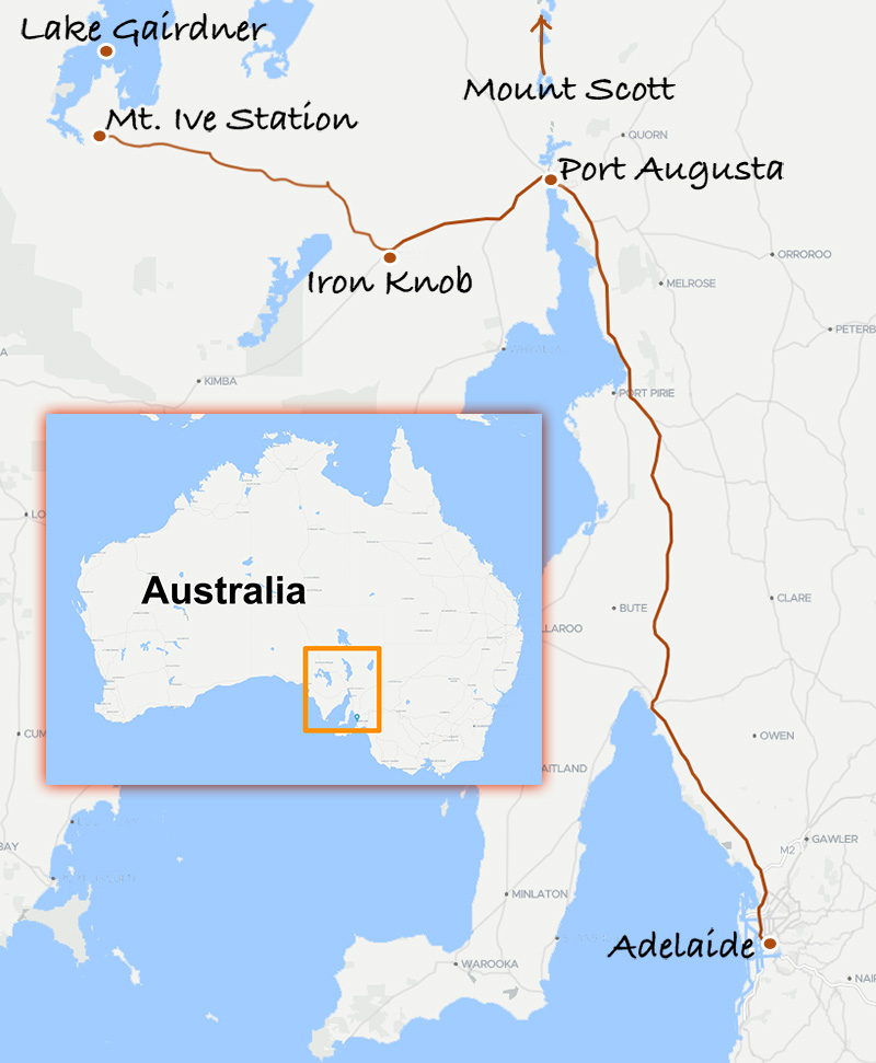
From Adelaide, it’s 309 km (192 mi) – a 3½ hour drive – along the fully sealed Stuart Highway to Port Augusta at the top of Spencer Gulf, an interesting destination in its own right. Take the Eyre Highway a further 65 km (41 mi) to the almost-ghost mining town of Iron Knob. Then take the Nonning Road for 128 km (80 mi) of dirt (or in our case, mud) roads all the way to Mount Ive Station. Allow seven hours for the trip from Adelaide when it is wet. There are some alternative routes with more sealed sections, but this route is the most direct.
Anyway, you’ve got to bite the bullet and get off the bitumen sometime!
The last leg passes through several pastoral properties en route to Mount Ive Station. That means cattle grids, gates, livestock and feral goats, along with highly variable surfaces like gravel, bulldust, mud puddles, rocks and salt pans, depending on the weather conditions when you travel.
After the rain, giant mud puddles covered the road in sections. But the tyre tracks going in came out the other side, so we figured if other vehicles had gotten through, then so could we. A couple of hours later, we reached the Mount Ive Station turnoff, about four kilometres (2.5 mi) from the main station complex, and marked by a distinctive replica semi-submersible submarine semi-submersed in the soil.
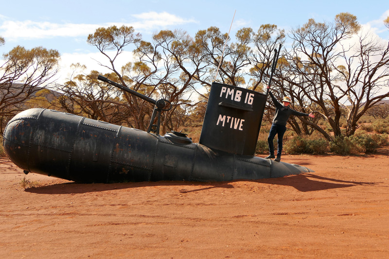
That’s a great photo opportunity right there.
The road into the station passes between Mount Ive (the mountain, not the station!) and Mount Scott. By world standards, they’re not very high, but the 360° panorama from the Mount Scott summit is superb, as we found out later in our stay. The view from the top of Mount Ive remains unknown – we didn’t reach the summit the day we attempted the climb, because we bailed out when we saw a huge rainstorm heading our way. Back at the station, we watched the surrounding plain – part of which is the station airstrip – turn into a lake.
But I’m getting ahead of myself.
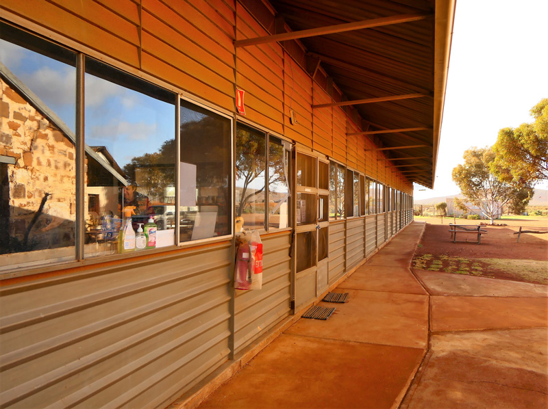
Choosing somewhere to stay at Mount Ive Station is almost as much fun as getting there. The accommodation area is dominated by large building of odd but distinctive design, a relocated relic from Maralinga, traditional home of the Maralinga Tjarutja people, but better known as a British atomic bomb testing site in the mid-1950’s.
This architectural masterpiece houses accommodation facilities (kitchen, dining room, showers, toilets, laundry) and the shearer’s quarters. The Stone Rooms and cottage are nicely renovated original stone outbuildings. But we chose a “donga”, one of a row of modular cabins, mainly for the ensuites (no middle-of-the-night dash outdoors to a Maralinga-style dunny for us!) and heating, essential for the cold nights during our end-of-winter stay.
Dotted throughout the station complex are outbuildings with more of that Maralinga blueprint magic. I’d forgotten to pack a geiger counter, so I couldn’t be sure if they came with a dose of Maralinga radioactivity, but as the original site was decontaminated twice, I felt pretty safe.
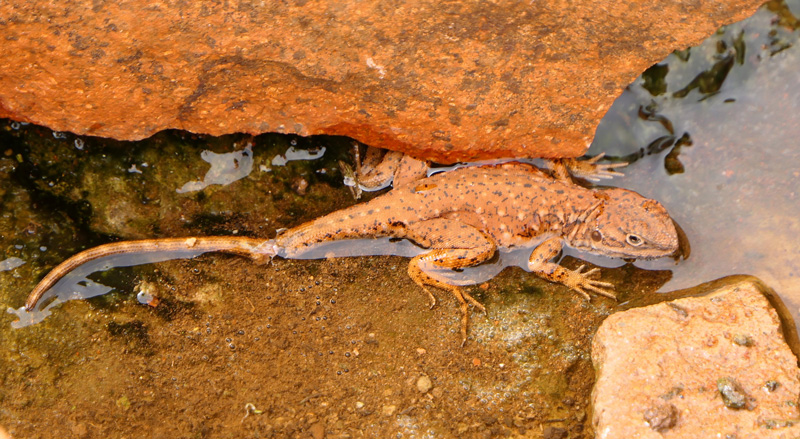
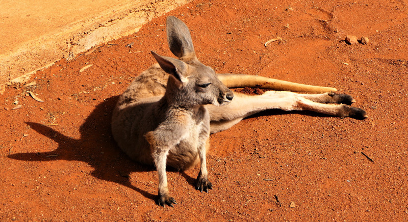
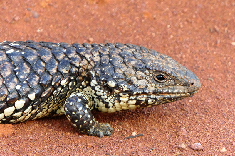
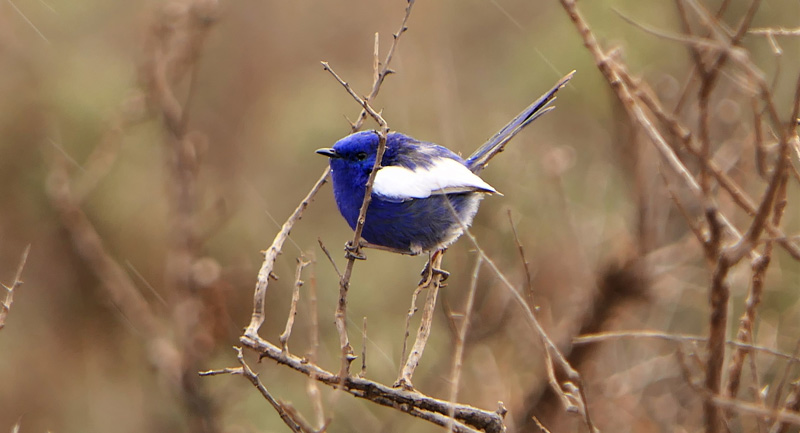
Besides, with an abundance of natural attractions and wide open spaces criss-crossed with 4WD tracks to explore on Mount Ive Station’s 930 square kilometres (230,000 acres), spending time in the outbuildings wasn’t a priority. A prime bird-watching location with several hard-to-find species present, it’s also a wildlife habitat for the Southern Hairy-nosed Wombat (and about a million kangaroos) and reptiles like the Peninsula Dragon, endemic to South Australia. The brilliant red Sturt’s Desert Pea, floral emblem of South Australia, can also be seen in season.
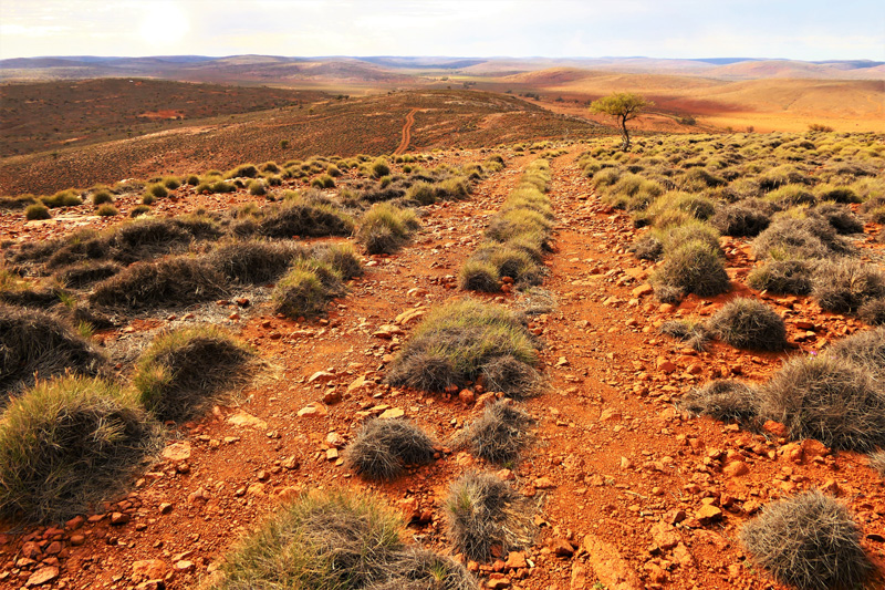
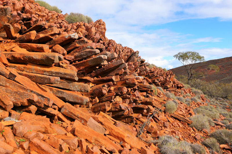
Driving the station 4WD tracks after rain is a sure-fire way to turn your 4WD adventure into an extreme 4WD experience, as we discovered on the ‘Flight Path’ track, when an unexpected wash-away appeared on a steep descent. With boulders on one side and a steep drop-off on the other, it gave us an ‘interesting’ (read: potentially-life-threatening) 15 minutes. But the classic Outback scenery with rocky lookouts over Mount Ive and Peterlumbo Hill, spinifex-covered hillsides, dry riverbeds and plains and our first glimpse of the famous rhyolite rock formations, common in this region, made it all worthwhile.
Commonly known as “organ pipes”, these prism-like multi-sided pillars were formed by columnar jointing during volcanic activity 1500 million years ago. The Gawler Ranges region boasts some of the largest volcanic rhyolite formations in the world, accessible in several locations on Mount Ive Station, and also in the nearby Gawler Ranges National Park.
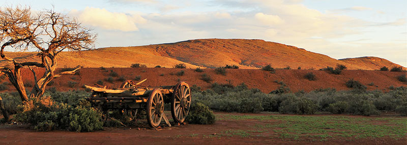
After our death-defying drive, we collected firewood for the evening’s entertainment – a campfire (the “Outback Television”) in the fire bucket next to our donga. But first, a visit to the Spinifex bar. If you ever go there, just pray that Sue has made her amazing lemonade scones, one of which can be yours for a small donation to the Royal Flying Doctor Service. You can always console yourself with a drink whether or not you’re lucky enough to score a scone!
If it’s raining, or you don’t want the bother of collecting firewood and lighting your own fire, the Mount Ive fire pit right outside the bar is always aglow in the evening. But don’t have too heavy a night – sunrise and early morning is so worth getting up for!
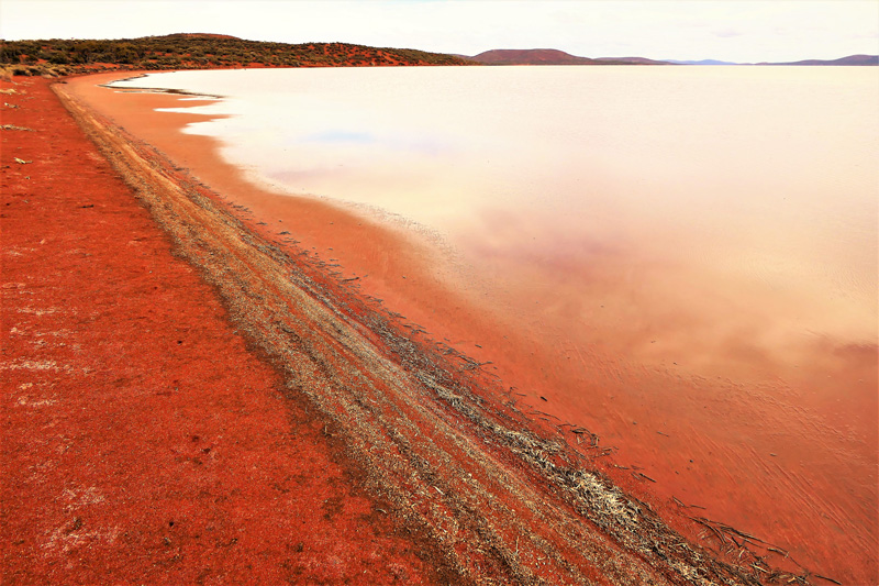
The northern boundary of the Mount Ive property is Lake Gairdner, 3rd largest salt lake (when full) in Australia. The lake is generally dry, a photogenic glaringly-white expanse of salt, but another group of campers we chatted to while preparing dinner in Maralinga mansion the night before, told us that the lake was actually full of water.
En route to the lake is another extensive rhyolite site with great views across the surrounding plains. Tumbling piles of rocks in that distinctive organ pipe formation line a deep valley through which a small creek flows. It is incredibly picturesque. A little further on lies the Embankment, a stonework dam built across a small valley which once stored water for livestock. In this marginal country, saving every drop of water could mean the difference between turning a profit and ruin.
But finally it was time for Lake Gairdner.
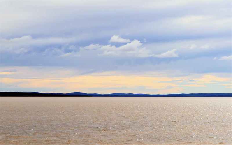
It’s hard to believe the massive expanse of water with lapping waves washing chunks of salt up on to the shore is ‘just’ a lake. At 160 km (99 mi) long and 48 km (30 mi) across, and, it’s more like the inland sea covering much of Central Australia that it was once part of. It’s visually easier to appreciate its size from a map – the southern inlet on which we stood gazing across to the red dunes and low ranges in the distance is just a tiny portion of the whole.
I could only imagine what a salt pan that size would look like!
Back in 1994, Rosco McGlashan attempted to break the world land-speed record on Lake Gairdner’s flat salt pan, driving Aussie Invader II, a jet-powered car. While he didn’t break the world record, he reached a speed of 802.6 km/h (500 m/h) to break the Australian land-speed record, which still stands. He would have been in big trouble if he’d attempted the record with a lake full of water!
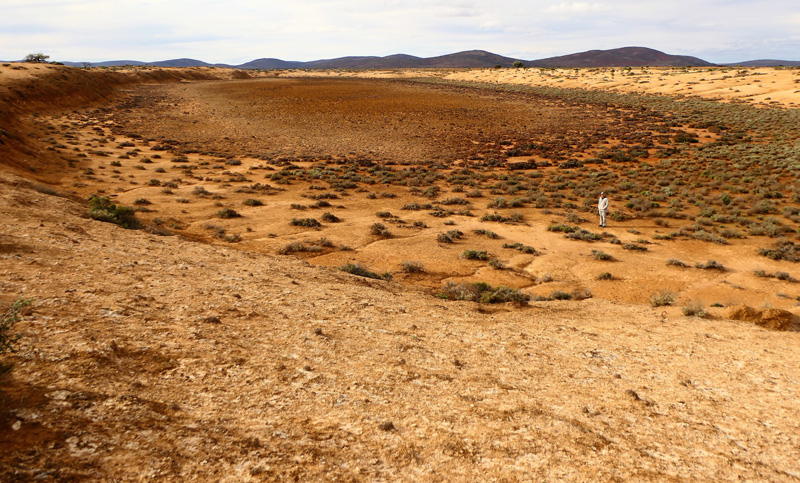
In contrast to the classic Outback scenery elsewhere on the property, across the road from the Mount Ive submarine, an area of golden, eroding rock full of caves and wombat burrows surrounding low, damp samphire flats forms a Badlands area in an almost post-apocalyptic landscape. With no sign of life in its otherworldly hollows and hills, we explored its nooks and crannies, until the lure of another evening of drinks and scones at the bar drew us back.
On our last full day at the station, we rose at dawn to pursue the elusive Short-tailed Grasswren, South Australia’s only endemic bird species, often found atop Mount Ive. It’s a longish walk to the summit over rough terrain, and endless clumps of spinifex, any one of which could have harboured this tiny bird.
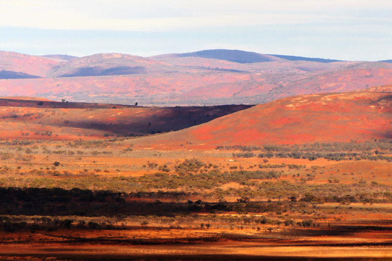
Non-birdos (like me) will find the early morning light, sweeping vistas, outback colour palette and solitude reward enough. Yes, sadly that means I didn’t get a photo of the grasswrens we saw, they moved way too quickly for my frozen fingers!
My photos don’t show the lashing rain squalls and hurricane winds that assailed us at the summit, or the shortcut down the hillside we took to escape them. But they do show a stunning outback landscape full of unusual natural attractions and vistas, and a place full of intriguing quirks and welcoming atmosphere.
Once you’ve been to Mount Ive, you’ll want to return!
Exploring the Aussie Outback with Red Nomad OZ!
FOLLOW MARION HALLIDAY:
Marion blogs as “Australia by Red Nomad OZ” at www.redzaustralia.com.
▷
Follow Marion @rednomadoz on Twitter, Pinterest, LinkedIn, and Flickr. Facebook: RedzAustralia.
▷
Buy her book: “Aussie Loos with Views!” at Amazon.com and eBay.com.

☛ Read more: Posts by Marion Halliday, the Red Nomad Oz


Marion is “Red Nomad OZ”, author, blogger and Aussie traveller who loves discovering nature-based attractions and activities – and scenic loos – all over Australia. Her Aussie travel blog and published book “Aussie Loos with Views” provide inspiration for other Aussie explorers.