When thinking about Pakistan, people generally have impressions of terrorism, natural disasters, poverty, and many other negative connotations. However, setting these aside, we also have visions of natural beauty, friendly people, tasty food, colourful festivals, lasting traditions, and many more.
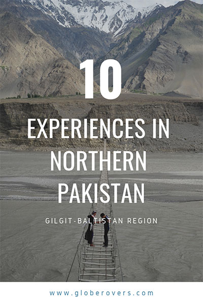
Gilgit-Baltistan – A remote mountainous region in the far north of Pakistan known for high snow-capped peaks, glaciers, lakes, rivers and more.
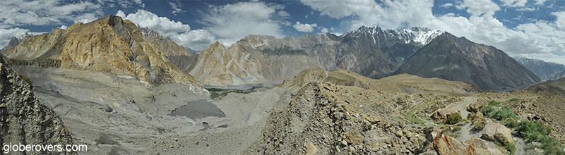
While Pakistan is a very diverse country with great natural beauty, it is the mountainous region in the north which has always captured my imagination. At the confluence of three mountain ranges: the Himalayas, the Karakoram, and the Hindu-Kush, lies Pakistan’s northernmost region – the autonomous territory of Gilgit-Baltistan.
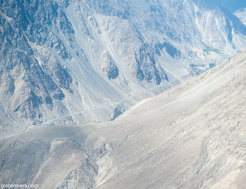
To the north-northwest of Gilgit-Baltistan lies a small portion of Afghanistan’s Wakhan Corridor “pan-handle”. Tajikistan is just a short hop north across the Wakhan Corridor. To the north-northeast is the wild frontier of China’s Xinjiang Uyghur Autonomous Region. The Indian-administered Jammu and Kashmir borders to the southeast and further south are the Pakistani-administered states of Azad Jammu and Kashmir. Geographically this region is untamed, remote, and perfectly suited for the intrepid traveller!
Here are my top 10 greatest experiences in this part of the world. Read my full article about travel in northern Pakistan in Globerovers Magazine, July 2015.
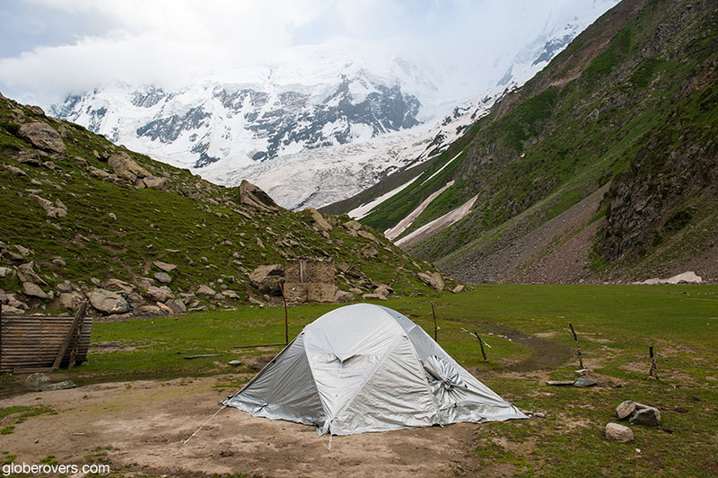
1. Minapin Glacier
Located at 3,640 m above sea level at the foot of the majestic Rakaposhi Peak, Minapin Glacier is a 5.5-hour strenous hike up from the village of Minapin Nagar. The village is close to the Hunza River at about 2,200 m.
The glacier is stunning and flanked by Rakaposhi (7,788 m), Diran (7,257 m), Hachindar Chish (7,163 m), and Ultar Peak (7,329 m).
Walk on the glacier but be careful of deep crevasses. Sleep in a tent next to the glacier and at night wake up from the rumble of avalanches and falling chunks of ice.
An unforgettable experience!
2. The Road to Tato
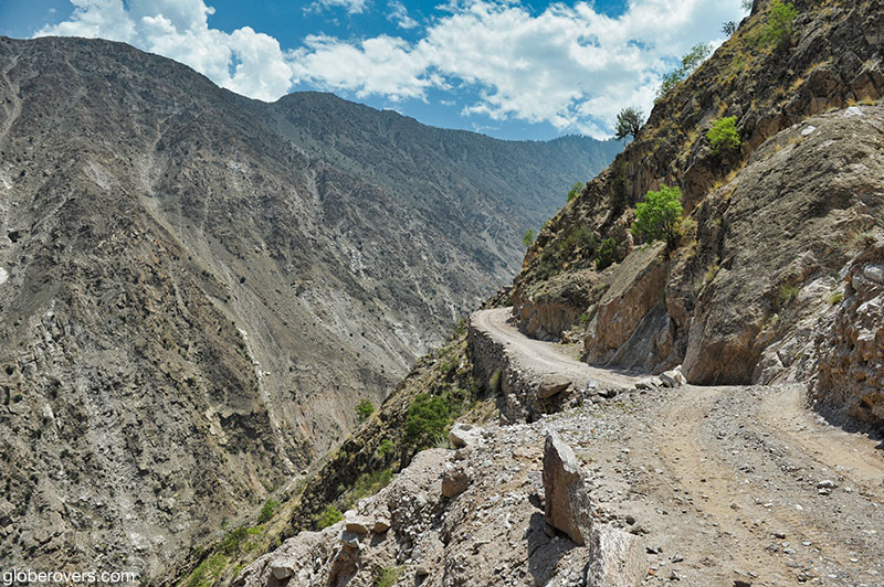
If you want to reach the basecamp of Nanga Parbat (8,126 m), or spend a few days at the peaceful Fairy Meadows (3,300 m), then your gateway is the road to the village of Tato from where you will walk a steep and scary path for another three to four hours to the Fairy Meadows huts.
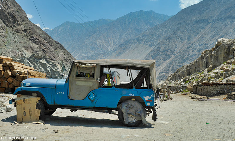
Hire an old jeep for the 12 km road trip which is listed as one of the scariest road tracks in the world. According to guides and local drivers, accidents are rare. However, landslides are quite frequent which sometimes wash away large sections of this small road which is precariously built with loose rocks along the steep mountains.
This is not an experience for the faint-hearted. But, as they say, it’s not the destination, but the journey to get there!
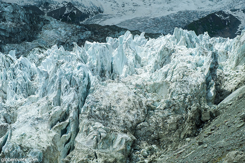
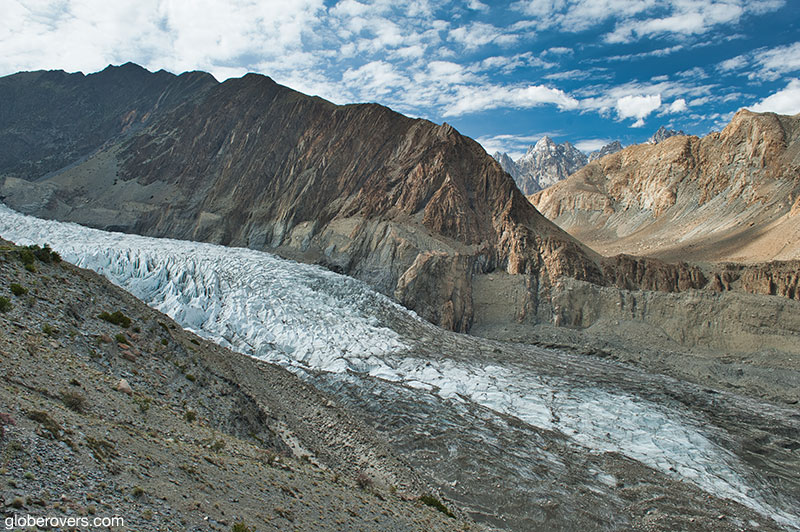
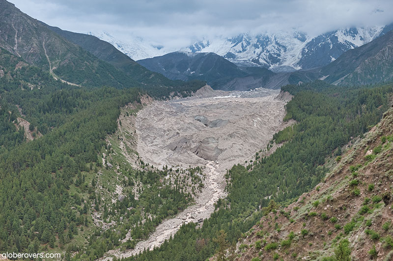
3. Passu Glacier
Located close to Passu Peak (7,478 m) and Batura Peak (7,795 m) in the Upper Hunza Valley (Gojal Valley), the glacier is linked with the 57 km long Batura Glacier which is one of the largest and longest glaciers outside the Polar regions.
While the lower parts of the glacier is a grey sea of rocks and gravelly moraine, the upper parts are quite white and reminiscent of old chunks of styrofoam!
Debatably more impressive than the glacier itself is the stunning theatre of mountain peaks around the glacier. The area is peaceful as few people reside in this part of Gilgit-Baltistan. Nearby is Mount Tupopdon (Passu Cathedral) and the very scary Passu Hanging Bridge.
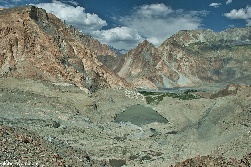
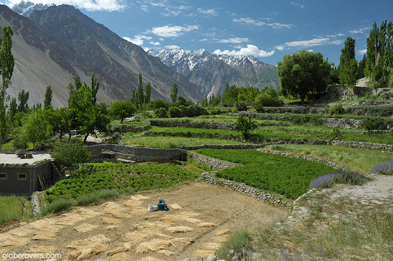
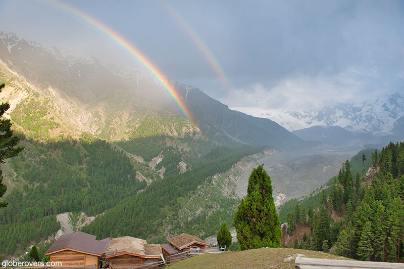
4. Hunza Valley
The Hunza Valley in Gilgit-Baltistan stretches roughly from north of the administrative capital of Gilgit all the way up to the China border. The Hunza River flows through much of the valley, flanked by several high peaks such as Rakaposhi (7,788 m).
The valley is roughly divided into the Lower, Central, and Upper Hunza. In addition to the majestic mountains and glaciers, the valley is known for its friendly people, good food and fruits, turquoise lakes, and excellent hiking trails.
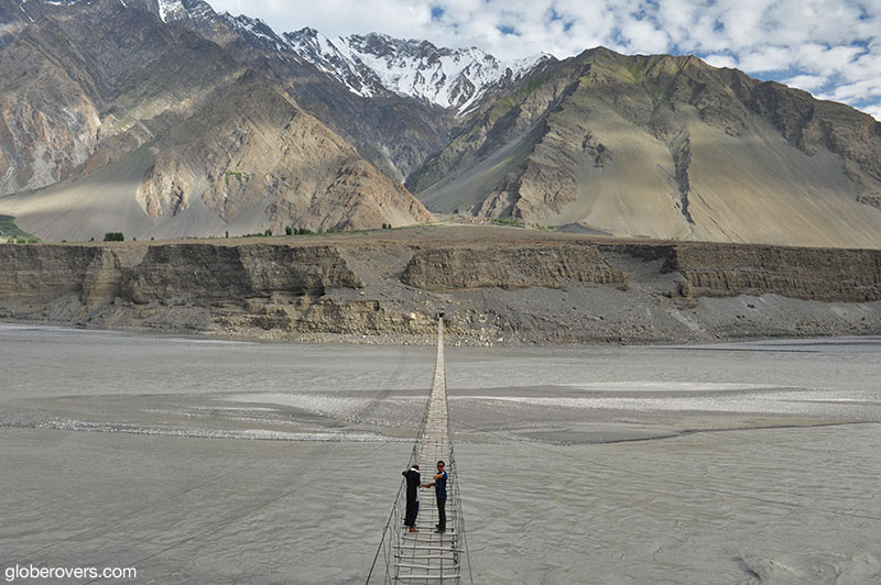
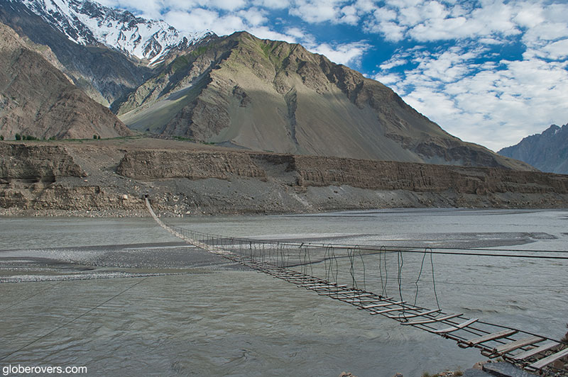
5. Passu Hanging Bridge
The Passu Hanging Bridge does not really deserve its reputation as one of the world’s most dangerous hanging bridges. While you may find it scary to walk on it, as long as you don’t slip through the planks and fall into the meandering stream, you will be perfectly safe.
Rather, it should be labelled as one of the most scenic hanging bridges in the world. The surrounding mountains, including Mount Tupopdon (Passu Cathedral) is breathtaking. Nearby is Passu Glacier.
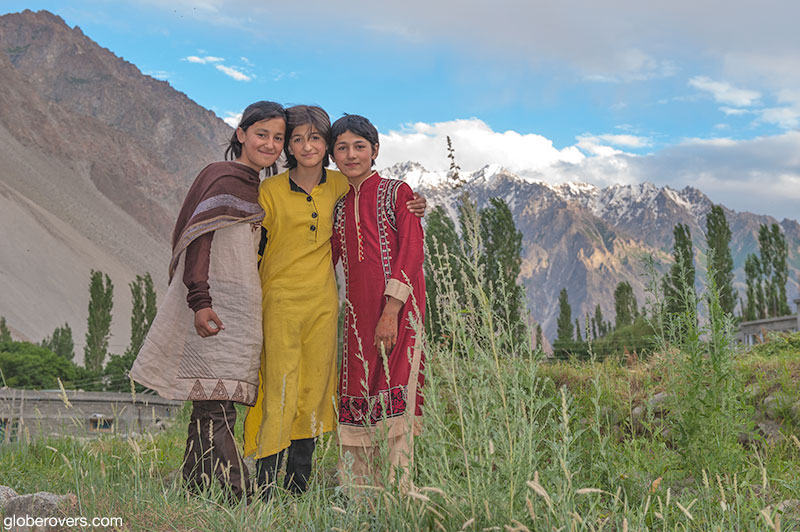
6. Gulmit Village
Located just north of the new Attabad Lake, Gulmit is the capital of the Gojal Valley.
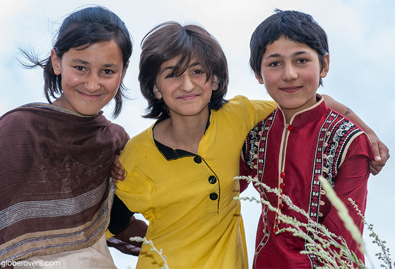
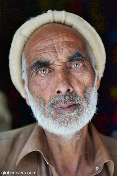
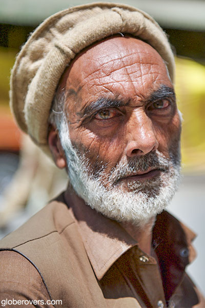
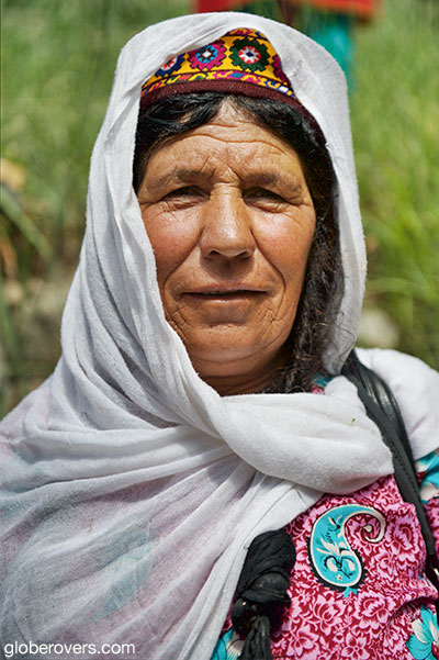
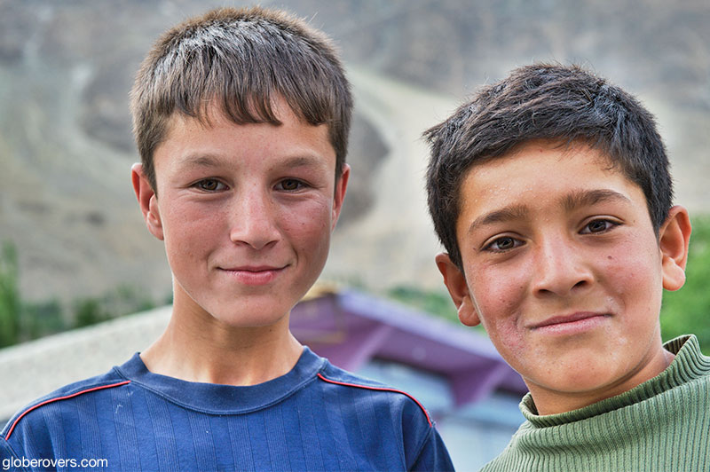
Many of the area’s residents are immigrants from Central Asia, most notably Tajikistan which explains why most people in this part of Gilgit-Baltistan are Wakhi-speakers and followers of the Ismaili sect of Shia Islam. The people are fair skinned with many having light brown hair and even blue and green eyes. In addition to being beautiful people, they are also incredibly friendly.
7. Fairy Meadows
An exciting destination in the Gilgit-Baltistan region is the Fairy Meadows, locally known as Joot. However, to get there, you have to take one of the scariest road tracks in the world (See: 2. The Road to Tato).
After the scary jeep ride and a 5 km hike, you will reach the Fairy Meadows on a lush green mini-plateau. Great views over Raikot Glacier and Nanga Parbat Peak. Watch out! The locals in the small village are very unfriendly and will yell at you for pointing a camera at them or at the village.
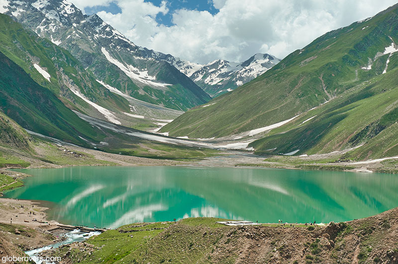
8. Kaghan Valley
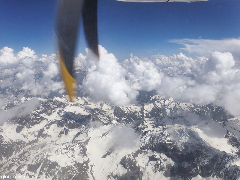
Flying from Islamabad to Gilgit is a great way to get to Gilgit-Baltistan. A great way to get back to Islamabad is by driving with a 4×4 via the Kaghan Valley and the town of Naran. The road goes through the Lulusar-Dudipatsar National Park.
The highest elevation point on the road is at the Bubusar Pass (4,173 m). At Naran (2,500 m) take a side-trip by Jeep up to Lake Saiful Muluk (3,224 m). The entire road through the Kaghan Valley is a beautiful part of Pakistan!
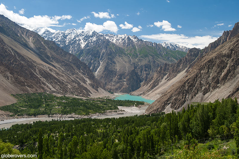
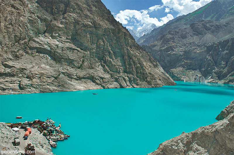
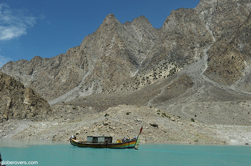
9. Attabad Lake
This was a peaceful meandering Hunza River running down the valley when on January 4, 2010, a massive landslide at Attabad Village killed twenty people and blocked the flow of the Hunza River. Now it is a large lake with the Karakoram Highway at the bottom.
Before the new road around the lake is recently opened, all traffic north went by boat – trucks included. A beautiful turquoise lake surrounded by mountains and a great boat ride indeed. Nowadays you need to take the road through many tunnels. Sadly no longer crossing by boat.
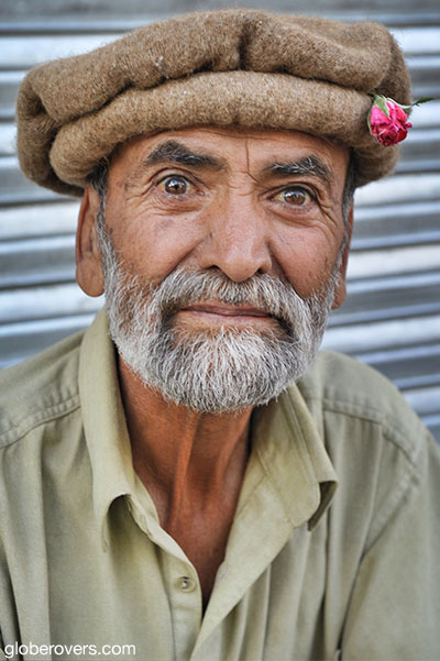
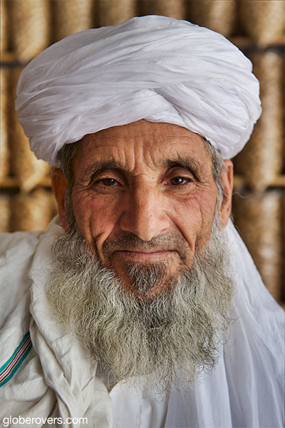
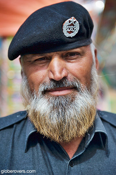
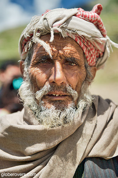
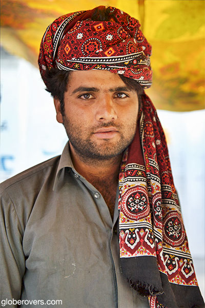
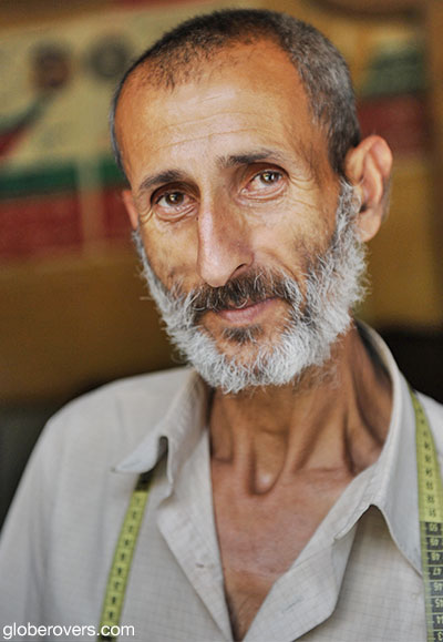
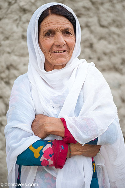
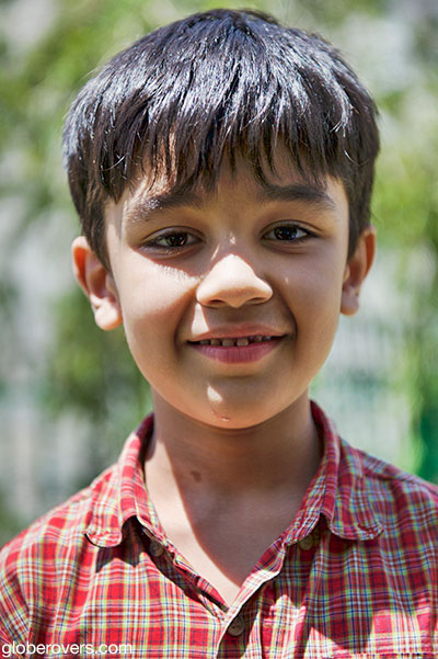
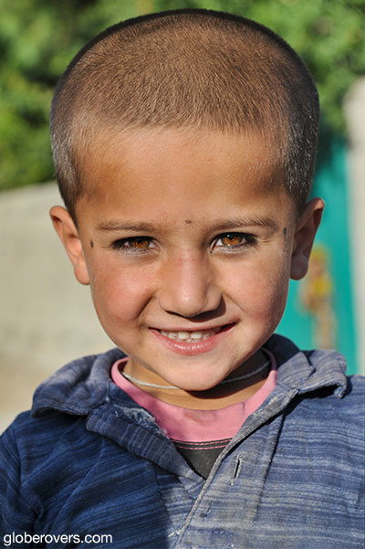
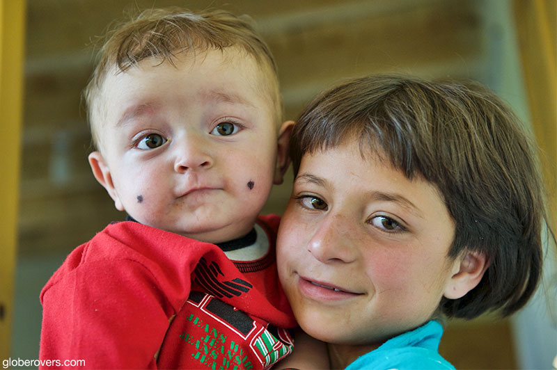
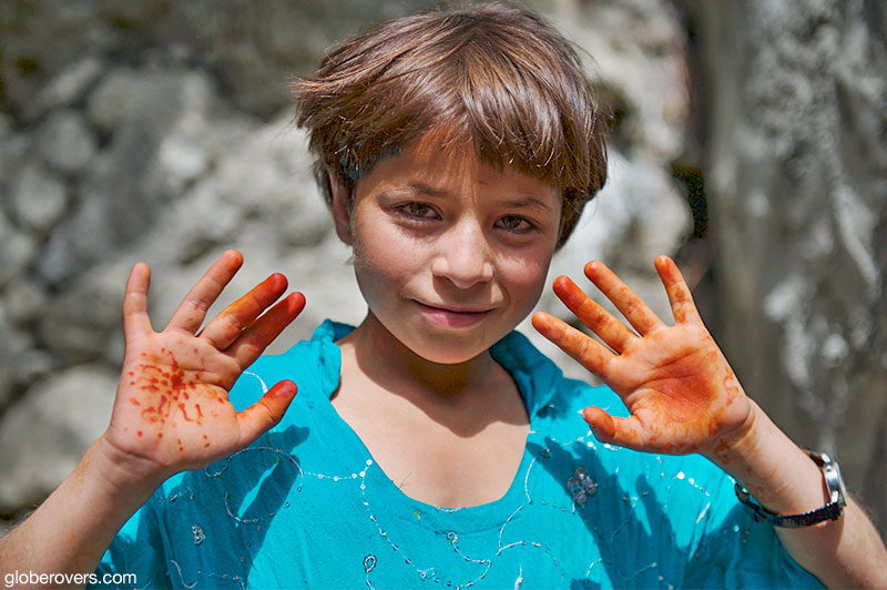
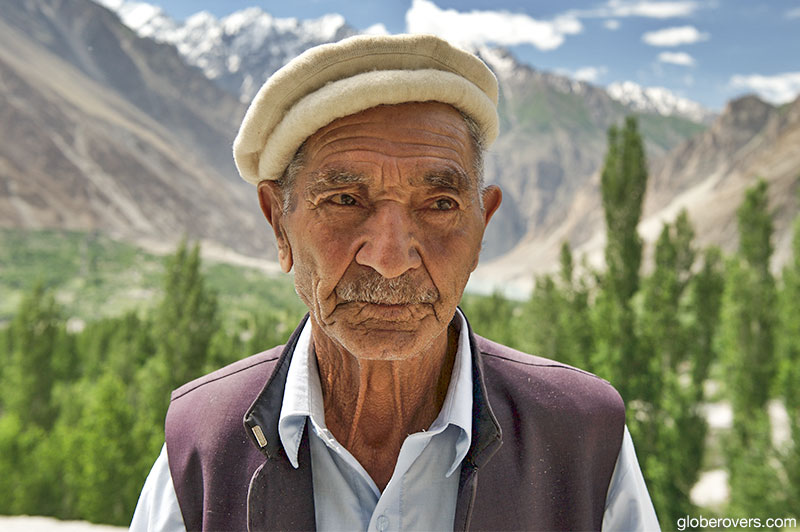
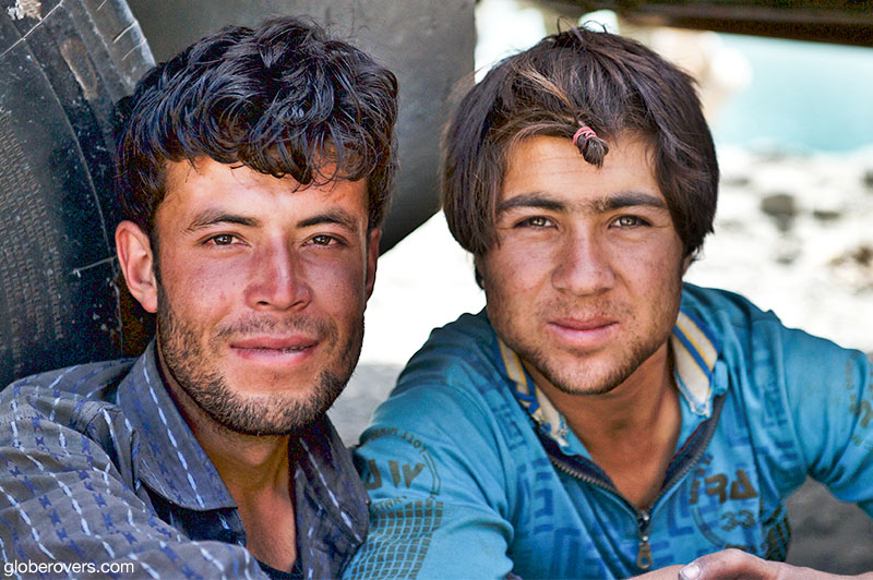
10. The people of Gilgit-Baltistan
Pakistan is known for its friendly people, and maybe even more so in the Gilgit-Baltistan region where the Hunza Valley is located. I found most people friendly except at the Fair Meadows village near Raikot Glacier and Nanga Parbat Peak.

Blog post and photos by Peter who has been travelling almost full-time since 2005 and has been to over 122 countries. He visited several countries, such as Japan, more than 20 times. Peter is Editor-in-Chief and Publisher of GlobeRovers Magazine, an independent travel magazine focused on intrepid destinations.