Words and Photos by Yrene Dee, Lumby (British Columbia, Canada).
Yrene is the founder of BackcountryCanadaTravel.com. She was born in Switzerland, lived and worked on different continents and travelled the world before she settled in Canada. She is an entrepreneur, wilderness nut, and animal lover who prefers off-the-beaten-track places. Follow Yrene on Twitter @backcountrycana, Facebook @ backcountrycanada, and Instagram @backcountrycanadatravel.
The 741 km long Dempster Highway stretches from Dawson City in Canada’s Yukon Territory up north to Inuvik in the Northwest Territories. It is one of the world’s most spectacular road trips and is the only road in Canada that crosses the Arctic Circle.
The route calls for a fantastic journey through an ever-changing landscape of mountains, open tundra, rivers and bogs. The road takes you into the land of the midnight sun, where you have 24 hours of daylight.
All you need for this trip is an adventurous spirit, a reliable vehicle, excellent tyres, a couple of spares, and a jerrycan with extra gasoline.
An all gravel surface to protect the permafrost, which the road sits on, the road is like a raised bridge with no sides. If the permafrost melted, the road would sink.
I was nervous about the challenge I was about to undertake, but the thrill of adventure was stirring wildly.

My road trip to the Arctic started far south in the Okanagan Valley, British Columbia, ten days before reaching the start of the Dempster Highway at Dawson City.
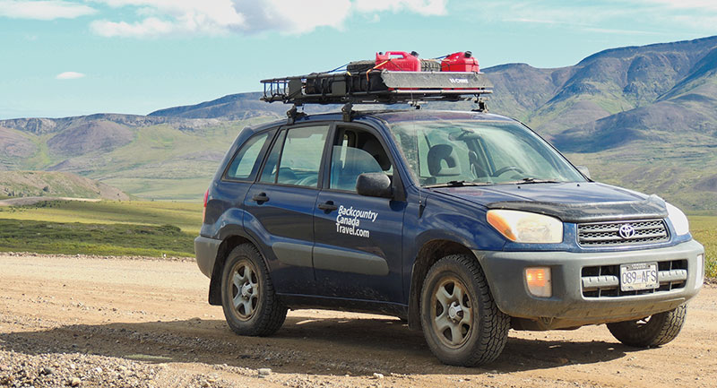
My Toyota RAV4 was equipped with the best all-season tyres I could find, so I was well prepared for the journey ahead. I realized early during my trip that things would be rough. The front windshield of my vehicle was rock-chipped before I even reached the Yukon border. Lesson learned: always come to a full stop whenever a semi-truck approaches to limit the amount and severity of rocks hitting the windshield.
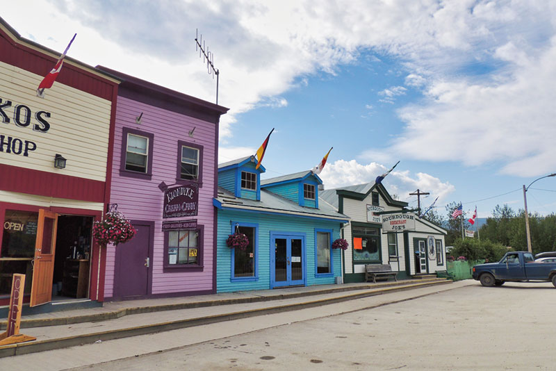
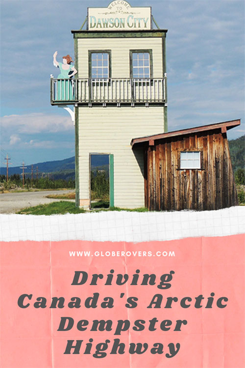
I took a break from my journey in the Wild West town of Dawson City, with my small tent squeezed between large RVs at Dawson’s main campground. Being aware of the remoteness and solitude of the road ahead, I didn’t mind the hustle and bustle of Dawson and tried to take in some of its vibes and Klondike history. The Klondike region lies around the small Klondike River, which flows into the Yukon River near Dawson City. Famed for its “Klondike Gold Rush” of the late 1800’s, Dawson City still retains some of the gold rush vibe.
By the time I arrived at Tombstone Mountain Territorial Park, 72 km northeast along the gravel highway, my car was covered in dust; my throat was dry, and my head was throbbing from manoeuvring through the rough terrain. I stopped briefly to marvel at the superb views of the Tombstone Mountains, filled up my water bottle at the Interpretive Centre and inquired about the road ahead. “Keep driving to make it across Eagle Plains another 300 km north. Rain is in the forecast!” I was advised.
I continued on the rough stretch across the Ogilvie Mountains and scaled the North Fork Pass (1,289 m), the highest elevation on the highway.
My adrenaline jumped a mile high when I heard an aircraft engine just as I was approaching the part of the Dempster that is often used as an airstrip. Luckily, the plane flew by.
Climbing and descending through the Eagle Plains and the subarctic tundra, I made it to the halfway point at the Eagle Plains Hotel, where I camped for the night and topped up the gas tank.

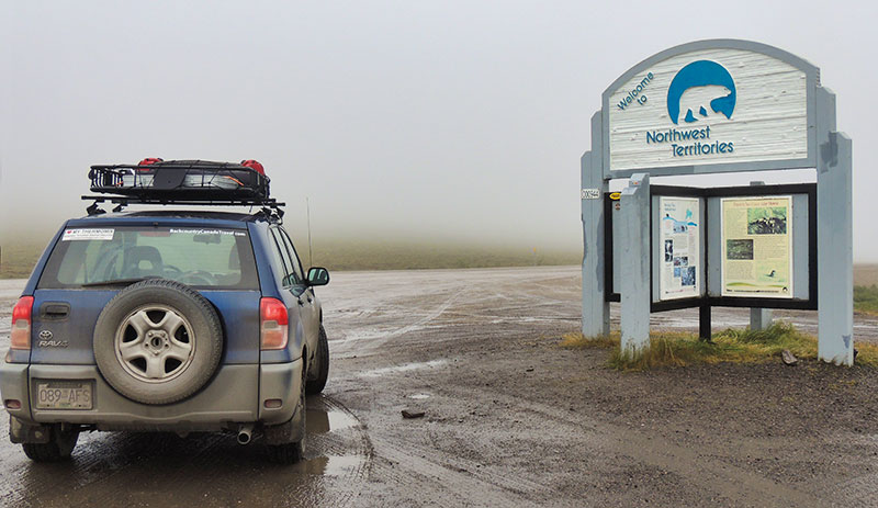
Thick, heavy fog and drizzling rain greeted me the next morning, warning me about what was yet to come. Nothing was going to be like the day before. The clouds hung low over the barren land when I reached the Arctic Circle at the 405 km marker. From here the highway turned into a deep muddy track and I had to travel at walking speed for about 50 km to the Yukon/Northwest Territories border. Once I passed Midway Lake, the road conditions slowly improved.
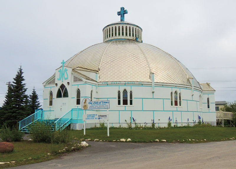
Soon after crossing the Peel River I reached the tiny Athabaskan-speaking Gwich’in Dene village of Fort McPherson, known for its traditional Tent and Canvas Shop.
The last thrill of the day was the rough Mackenzie River ferry crossing at the 608 km marker further northeast of Fort McPherson. The area from here all the way north to the Beaufort Sea is scattered with tens of thousands of small lakes!
It was an amazing feeling to reach the end of the legendary Dempster Highway and arrive in Inuvik, a sleepy town that saw its glory days during the gas and oil boom in the 1990s. Today, the town is a vibrant mix of Inuvialuit (Western Canadian Inuit people), the Athabaskan-speaking Gwich’in people, and some non-native residents. Inuvik is Mile 0 on the brand-new Inuvik to Tuktoyaktuk Highway. Tuktoyaktuk is located in the extreme far north of Canada along the Beaufort Sea, 150 km north of Inuvik. Another story, for another adventure!
As I stood here in Inuvik, thankful that I made it to the end of the Dempster Highway, I quickly remembered that my journey was just beginning and that it was a long drive back to Dawson City.

Yrene is the founder of BackcountryCanadaTravel.com. She was born in Switzerland, lived and worked on different continents and travelled the world before she settled in Canada. She is an entrepreneur, wilderness nut, and animal lover who prefers off-the-beaten-track places.