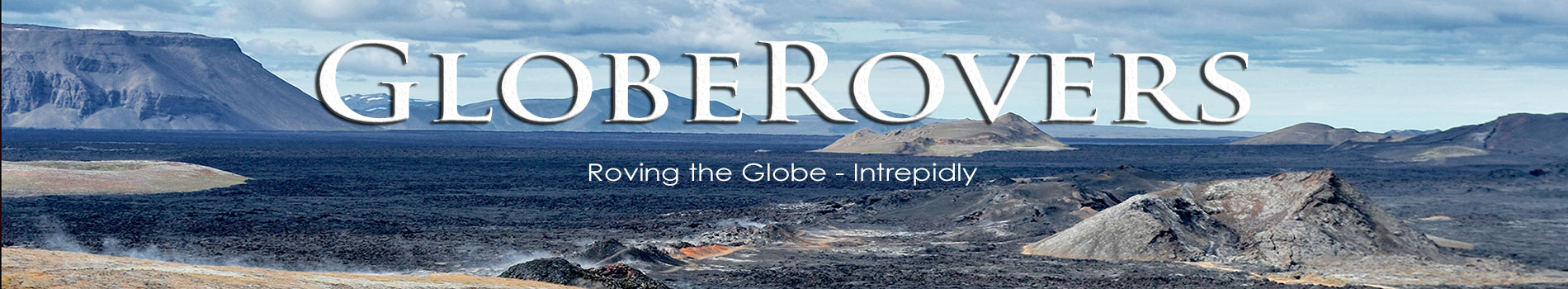
While Pakistan is a very diverse country with great natural beauty, it is the mountainous region in the north which has always captured my imagination. At the confluence of three mountain ranges: the Himalayas, the Karakoram, and the Hindu Kush, lies Pakistan’s northernmost region – the autonomous territory of Gilgit-Baltistan.
To the north-northwest of Gilgit-Baltistan lies a small portion of Afghanistan’s Wakhan Corridor “pan-handle”. Tajikistan is just a short hop north across the Wakhan Corridor. To the north-northeast is the wild frontier of China’s Xinjiang Uyghur Autonomous Region. The Indian-administered Jammu and Kashmir borders to the southeast, and further south are the Pakistani-administered states of Azad Jammu and Kashmir. Geographically this region is untamed, remote, and perfectly suited for the intrepid traveller!
Gilgit, gateway to the far north
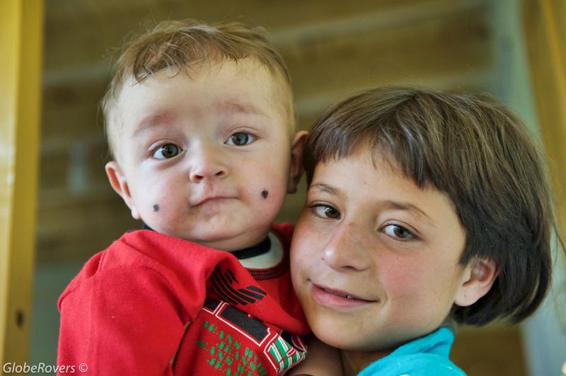
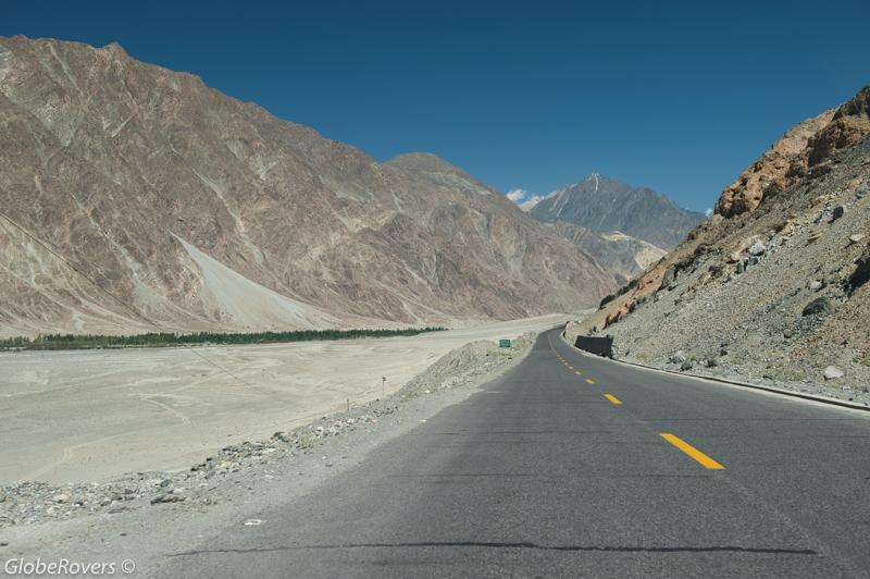
The capital of the Gilgit-Baltistan region is the town of Gilgit, which is the largest town on the Karakoram Highway before reaching the China border.
While a private vehicle from Pakistan’s capital, Islamabad, can make the journey north to Gilgit via the Karakoram Highway in about 15 hours (12 hours via Naran in the Kaghan Valley), public busses take about 18 hours as they leave Islamabad throughout the afternoon and arrive mid-morning on the next day.
A remote mountainous region in the far north of Pakistan known for high snow-capped peaks, glaciers, lakes, rivers and more.
By far the most convenient, yet always risky of last-minute cancellation, is the hour-long flight on Pakistan International Airways (PIA). PIA usually has two scheduled flights per day, departing in the early morning, on a French-Italian manufactured ATR 42 twin-turboprop aircraft.
Due to extreme weather changes in the north, flight delays or even cancellations are a normal and frequent occurrence. No wonder there have been no serious accidents and incidents on this ATR 42 aircraft route.
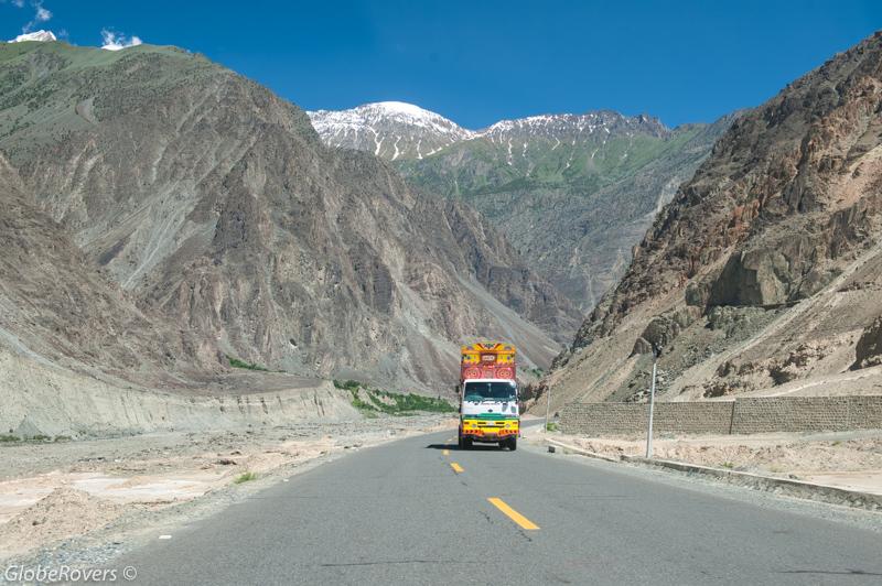
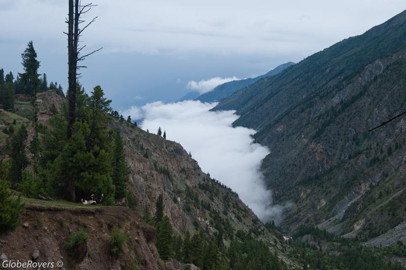
The town of Gilgit is situated along the Gilgit River and is surrounded by stunning mountain scenery. Gilgit makes an excellent central base from which to arrange trips in all directions: to the north lies the Hunza Valley; to the east and southeast is the Central Karakoram National Park which includes the beauty around Skardu; to the south lies the Deosai National Park and the lush Kaghan Valley; and, to the west is the Shandur National Park.
While most visitors to Gilgit-Baltistan come for the majestic snow-capped mountains and their accompanying glaciers and lakes, the region offers much more…
Venturing further west, beyond the boundaries of Gilgit-Baltistan, is the Chitral District of the Khyber-Pakhtunkhwa province with its colourful Kalash people.
Therefore, it makes perfect sense to use Gilgit as a base from which to explore the entire northern areas of Pakistan.
Hotels in Gilgit are plentiful and several local attractions are worth visiting, such as the Gilgit Bridge over the Gilgit River and the authentic bazaars. A few attractions outside town can be visited on day trips, such as the Kargah Buddha (a rock engraving of Buddha from the 7th century AD), the monument of Taj Mughal, the Naltar Valley, and many interesting one or two-day trekking routes.
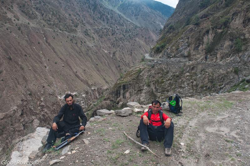
A few weeks or months before arriving in Gilgit, get in touch with one of the most experienced and professional guides of the Gilgit-Baltistan region. Nasir Ahmed has been a resident of Gilgit for many years and knows the entire area very well. He specialises in personally taking out individuals or small groups into any direction.
Nasir is well connected in the region to arrange anything and everything that trekkers of all expertise require. If he is not available to do personal guiding at any specific time, he will arrange for a friend to stand in for him. However, he will still be involved in the planning of the trip. (See end of the article for his contact details).
The Scary Road
One of the most exciting destinations in the Gilgit-Baltistan region is the Fairy Meadows, locally known as Joot.
However, the real excitement is not so much the end destination, but the journey to get there.
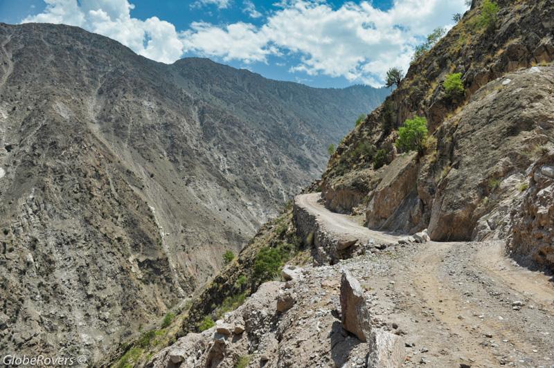
About 78 km south of the town of Gilgit is the famous Raikot Bridge (1,100 m) over the Indus River. On the east side of the river banks, just across the bridge, is a small settlement with an aptly named Shangri La Hotel. At PKR 2,000 (US$20) per night for a double room, it is quite a good deal, though the restaurant is basic with food and drinks being limited and over-priced.
It’s not the destination, but the journey to get there!
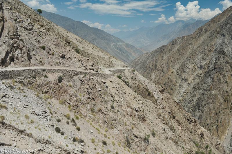
This 12 km road is listed as one of the scariest road tracks in the world.
This is the gateway to the basecamp of Nanga Parbat (8,126 m) and Fairy Meadows (3,300 m).
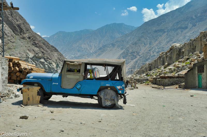
Negotiate a fare with one of the many small jeeps for the approximate one-hour drive (12 km) on one of the scariest roads in the world.
This is truly one of the scariest and most dangerous roads in the world.
According to guides and local drivers, accidents are rare. However, landslides are quite frequent which sometimes wash away large sections of this small road which is precariously built with loose rocks along the steep mountains.
This is not an experience for the faint-hearted.
The jeep trip terminates near the village of Tato, across a 6 m deep gorge and stream with no bridge. Carefully walk down the gorge, cross the stream by walking over the make-shift log, head up the gorge and into the small settlement.
From here it is another three to four hours (5 km) of steep hiking along the small path up to the lush green mini-plateau referred to as the Fairy Meadows. In total, the altitude climb from Raikot Bridge to Fairy Meadows is about 2,200 m.
Fairy Meadows
Fairy Meadows has a small community of rather unfriendly and camera-shy residents.
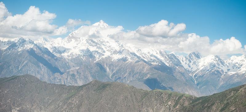
The community benefits financially from the tourists who annually spend about PKR 17 million (US$160,000) mainly on food, transportation and accommodation. Don’t even take a photo in the general direction of someone, or even the village, and you will hear wild screams of “No photo!” These people are so out of character with that of the Gilgit-Baltistan people who are very friendly and welcoming.
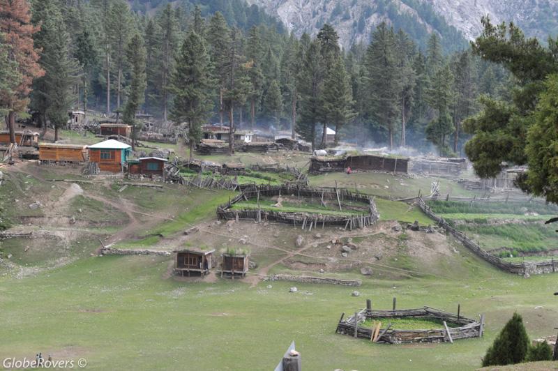
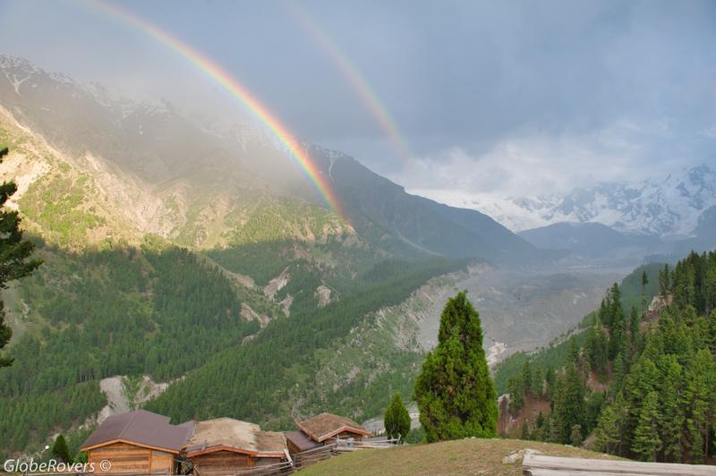
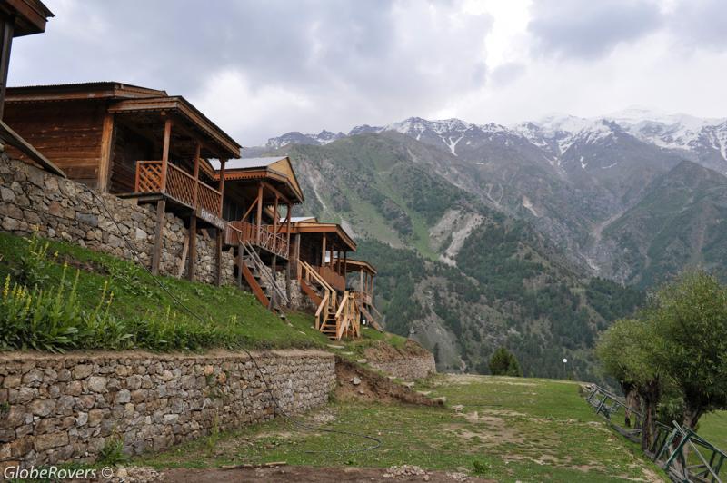
The “resort camp” at Fairy Meadows is referred to as Raikot Serai and has a couple of fairly basic huts for rent, as well as ample space to set up a tent. Some of them have open views of the Raikot Glacier and north face of Nanga Parbat, commonly referred to as the “Raikot Face”.
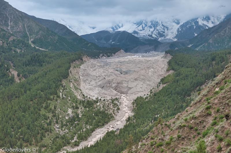
Hike up north of the village, all along the right side of Raikot Glacier which originates from Nanga Parbat Peak.
After about an hour of hiking through lush forests, you will arrive at the foot of Nanga Parbat. From here, on a clear day, the views of the mountains and glaciers are stunning. Nanga Parbat, also referred to as “Killer Mountain”, is the ninth highest mountain on earth and the second highest in Pakistan.
There is so much to explore in the Gilgit-Baltistan region that a few months are required. It is not uncommon for some trekkers to spend two or three months in the region. If money and time are not an issue, head up to Gilgit-Baltistan for one of the most incredible trips of your life!
☛ Read more: All Posts of Pakistan
☛ Read more: 8 Reasons to Visit Pakistan’s Gilgit-Baltistan
☛ Read more: Top 10 Experiences in Pakistan’s Gilgit-Baltistan


Blog post and photos by Peter who has been travelling almost full-time since 2005 and has been to over 122 countries. He visited several countries, such as Japan, more than 20 times. Peter is Editor-in-Chief and Publisher of GlobeRovers Magazine, an independent travel magazine focused on intrepid destinations.