Hikers in the Nepalese Himalayas have two serious choices: The Khumbu (Everest Base Camp) western region, or the Annapurna eastern region. GlobeRovers has done both but spent more time in the Everest region.
Both areas are incredibly scenic but if you can only do one, then it will be a difficult decision which may be best answered by the flip of a coin. Still, the best advice is to do both. They are very different and they are both very spectacular.
In this post, I will only talk about the Everest region as this is where I spent more time, and truly enjoyed a 16-day triangular hike that included Everest Base Camp.
Why Hike to Everest Base Camp?
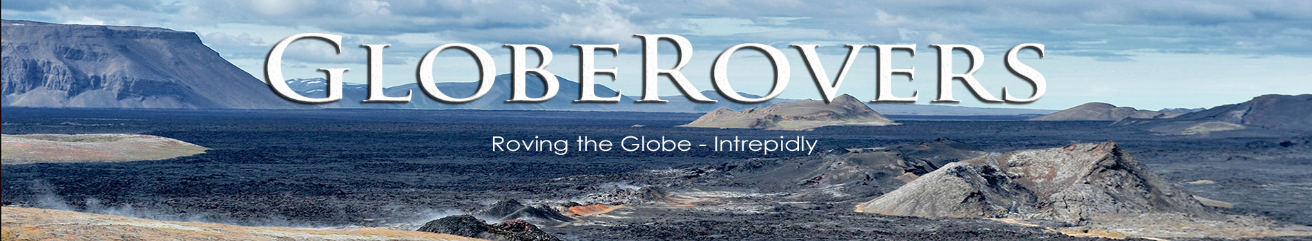
- The low-down: Hiking snow-capped mountains anywhere is an absolute must for those who love the mountains. Nepal is blessed with some of the best hiking trails, combined with quaint mountain villages, massive glaciers, sky-high peaks, and incredible mountain scenery. Few things are more exhilarating than getting a close-up look at Everest, the world’s tallest mountain peak!
- The brightest highlight: Reaching Gokyo (5,357 m | 17,575 ft) is such an achievement. Climb the nearby hill (Gokyo Ri) to the northwest of the guesthouses for stunning views of Mount Everest at sunrise. The same is true for climbing Kala Patthar (5,545 m | 18,192 ft) at sunrise. Kala Patthar lies above Gorak Shep, close to Everest Base Camp, and offers the most accessible close-up views of Mount Everest. Don’t forget to pray for clear skies!
- Intrepid destination: The number of hikers in Nepal’s Himalayas is constantly increasing, so sadly, it is getting very busy. Only time will tell what impact Covid-19 will have on tourism. Plan carefully. Feb-May and late Sep-Nov are the main trekking months. The best time is either side of the late-May to mid-Sep monsoon season. Some hikers claim the very best months are March, or late October and even November. Trekking in winter is possible though I personally would not want to do that. January and February can be very cold higher up the mountain and a lot of snow can be dumped on the trails – which is possible at any time of the year, though obviously more guaranteed during winter.
- GlobeRovers score (10 is highest): The Himalayas of Nepal is incredible, and so is the entire hiking experience, provided nothing bad happens to you! It gets a GlobeRovers score of 9.7 out of 10.
QUICK TRAVEL TIP
Once you get to Nepal’s capital, Kathmandu, spend a day or two asking fellow travellers if they have a good guide to recommend. In Kathmandu, rent high-quality equipment and warm clothing at the right stores – excellent quality is available at very reasonable fees. Fly to Lukla and do at minimum a 16-day hike in the Everest region. Afterwards, go back to Kathmandu and then fly west to Pokhara. From here, take a 10 to 15-day hike up to Mount Annapurna. Make sure to spend a few days in Pokhara. Your guide will look after guesthouse bookings all the way. Be warned: the higher up the mountain, the more basic the lodging and food get.

Table of Contents
Everest Base Camp Gateway: Lukla
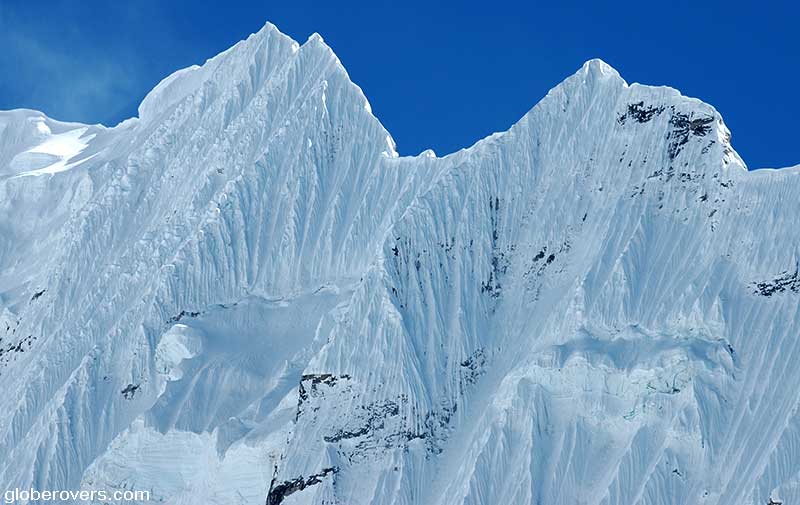
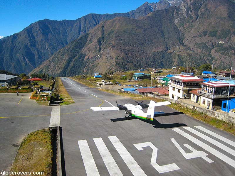
The Everest region trekking starts at the little village of Lukla (2,850 m | 9,350 ft) that is a 25 to 45-minute scenic flight from the Nepalese capital, Kathmandu. Lukla is notoriously unreliable for flights due to the unstable weather, so don’t be surprised if the small plane of Yeti Airlines is delayed or cancelled in Kathmandu. Operators change often and may include Tara Airlines, Sita Air, and Summit Airlines.
The short airstrip (just 351 m | 1,151 ft long) at Lukla, officially known as Tenzing Hillary Airport, is at an approximately 10-degree angle and it is a thrill to see the small planes landing and taking off.
When you are on the plane yourself, you may wonder why people next to the landing strip stare in disbelief! There is little margin of error for mistakes – if the plane can’t stop in time, or doesn’t take off in time, it will tumble deep down the cliffs.
Adjust to the altitude at Phakding or Namche Bazar
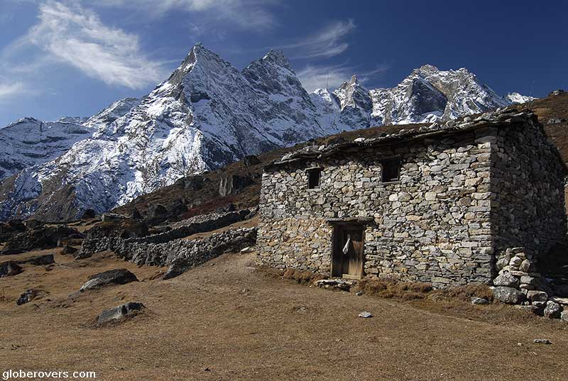
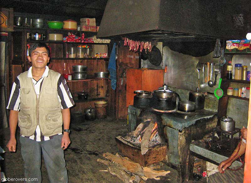
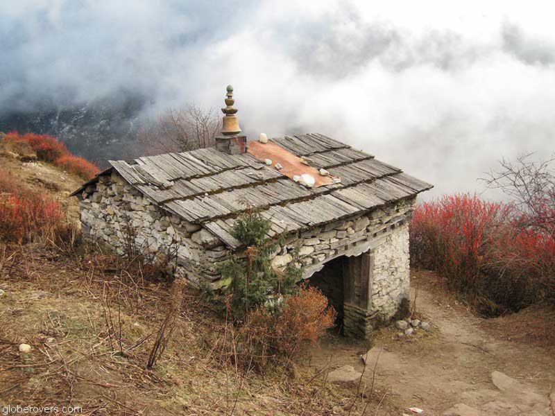
From Lukla, it is a rather boring walk (compared with the rest of the hike) of 7.8 km (4.8 mi) to the village of Phakding (2,610 m | 8,563 ft). The village lies along the Dudh Kosi river valley and is at a slightly lower altitude than Lukla which makes it an ideal place to have your first overnight and an early adjustment to the mountain’s altitude. The village has a few basic travellers’ restaurants, though you will soon realize that they are much better than the restaurants higher up the mountain.
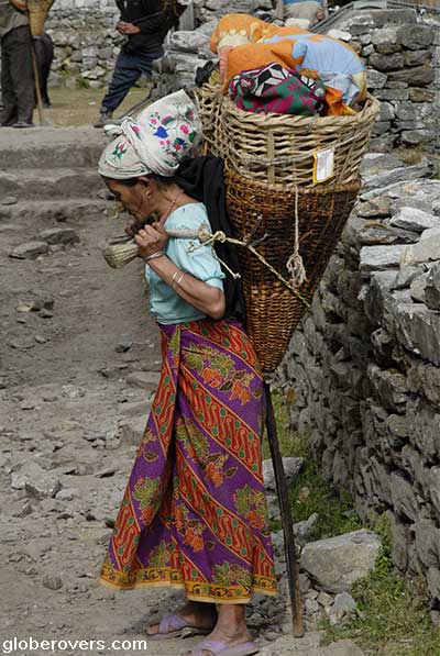
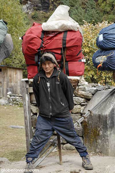
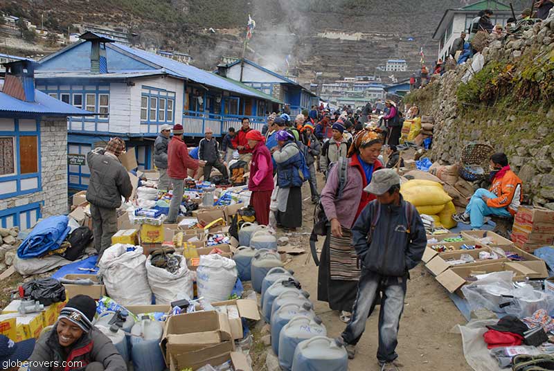
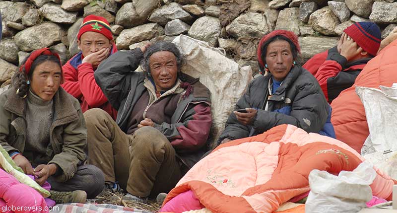
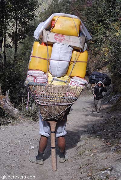
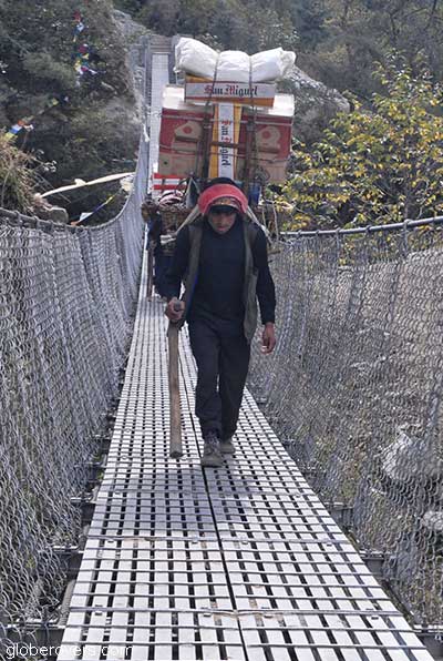
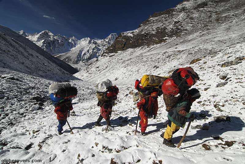
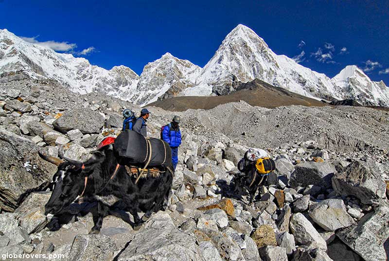
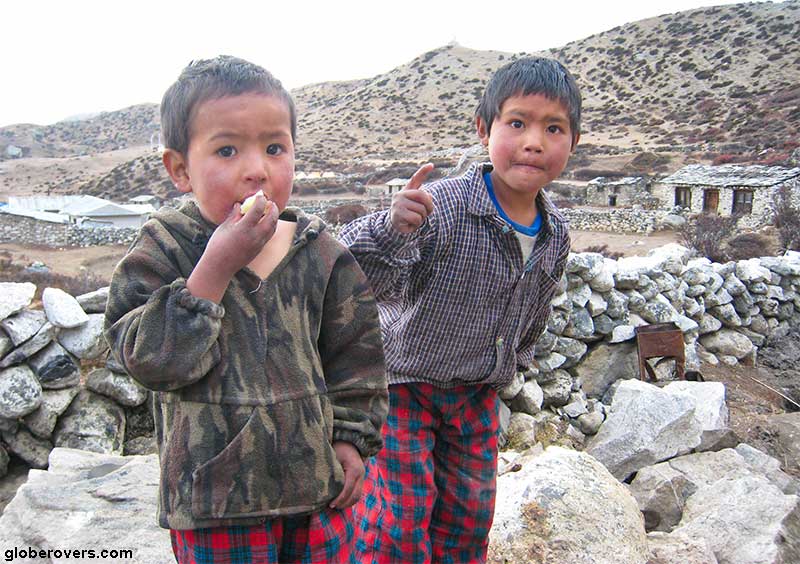
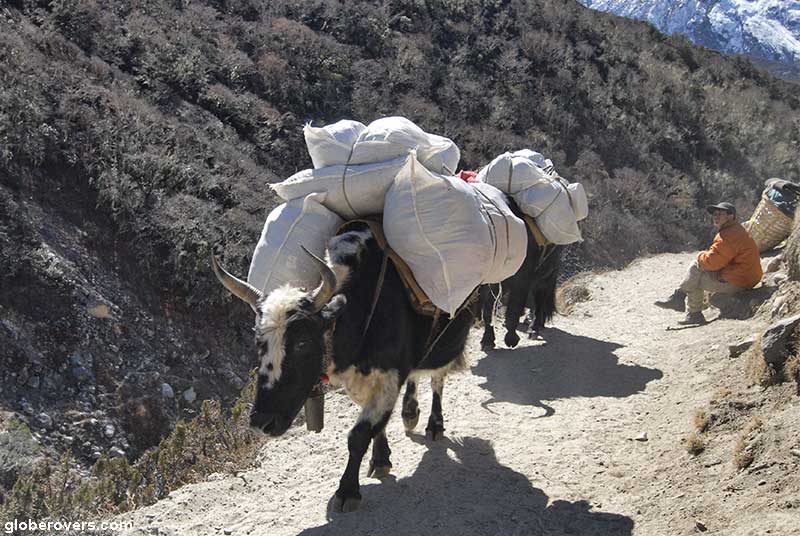
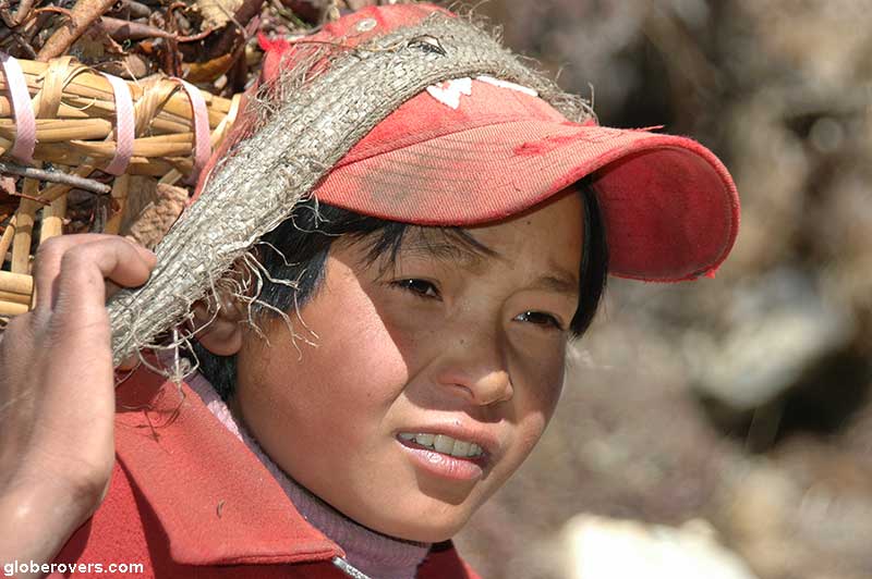
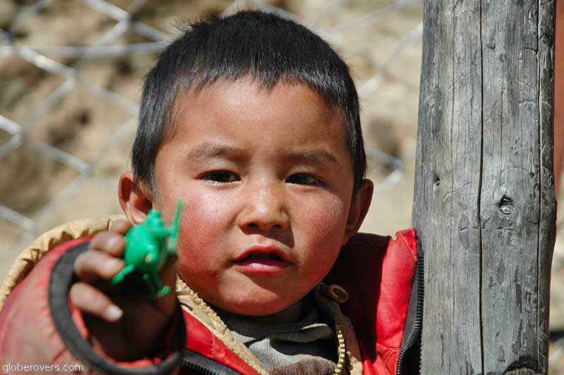
Phakding is also the first congregation point for the many porters carrying food and other necessities to settlements higher up in the mountains. There are no roads in this part of the Himalayas, and humans are used rather than pack animals to move everything. Some porters also carry the luggage of lazy hikers who brought way too much luggage.

The 16-day hike passes by several Sherpa villages and glaciers.
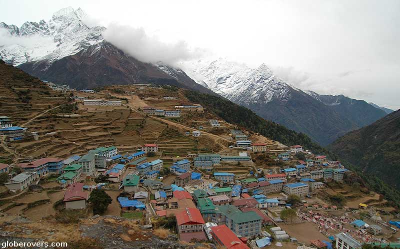
The well-trodden hiking path from Phakding continues for just over 10 km (6.2 mi) to the truly beautiful terraced mountain village of Namche Bazar.
Always follow the golden rule of the high mountains:
Hike High – Sleep Low!
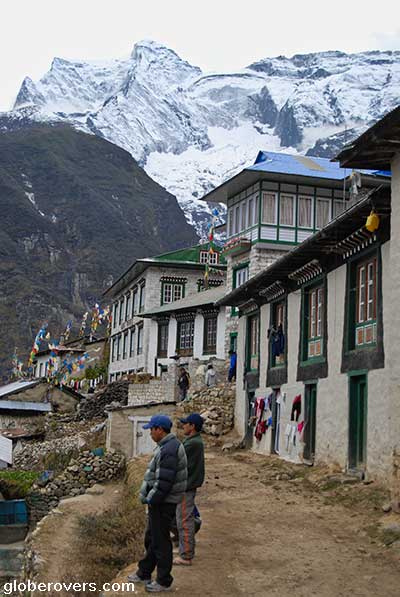
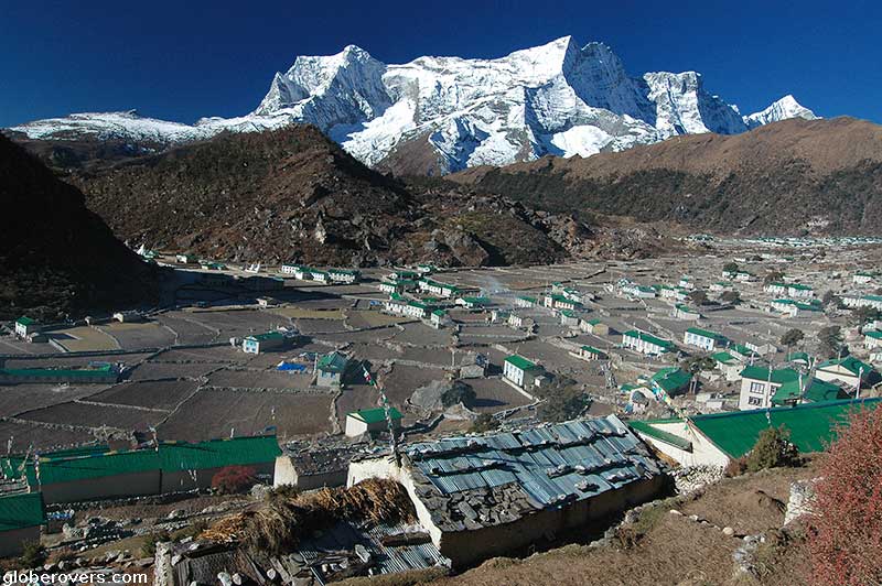
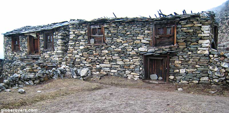
Namche Bazar, located within the Khumbu area, has a population of about 2,000 people. It is an important trading centre for supplies to people living higher up in the mountains, as well as for Tibetan tradesmen who cross the mountains to sell their textiles to the Nepalese.
Tucked away in a “mountain superbowl” at a height of 3,440 m (11,286 ft) at the low point, this is where most hikers stay (for a few days) to get used to the higher altitude.
The area has ample hills to hike and get used to the altitude. Here you can practice the rule of “hike high and sleep low”. At times you will feel very dizzy, but don’t get alarmed, it is normal. Take a rest and continue. As long as you sleep lower than your high hikes, you will be fine – most likely!

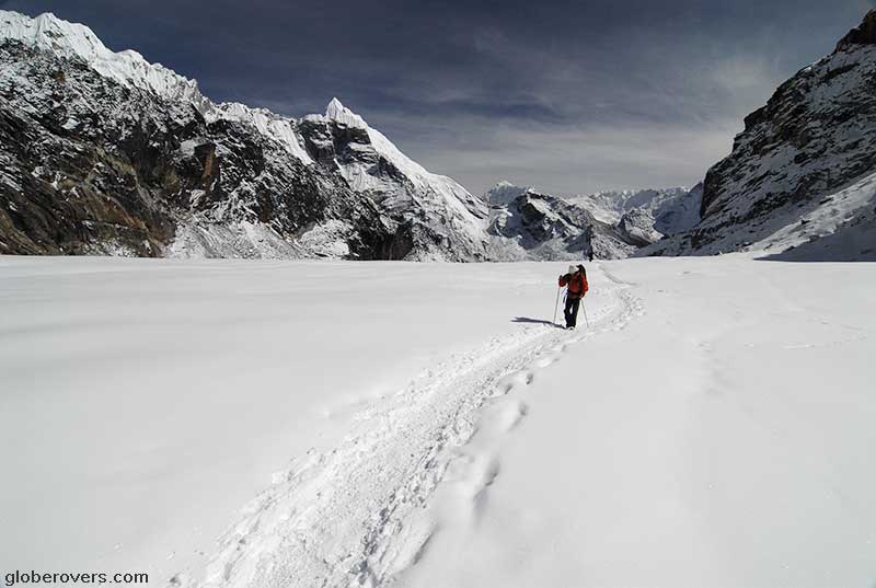
Stunning scenery: Namche Bazar to Gokyo
From Namche Bazar to Gokyo is a 23 km (14.3 mi) hike past some stunning mountain scenery.
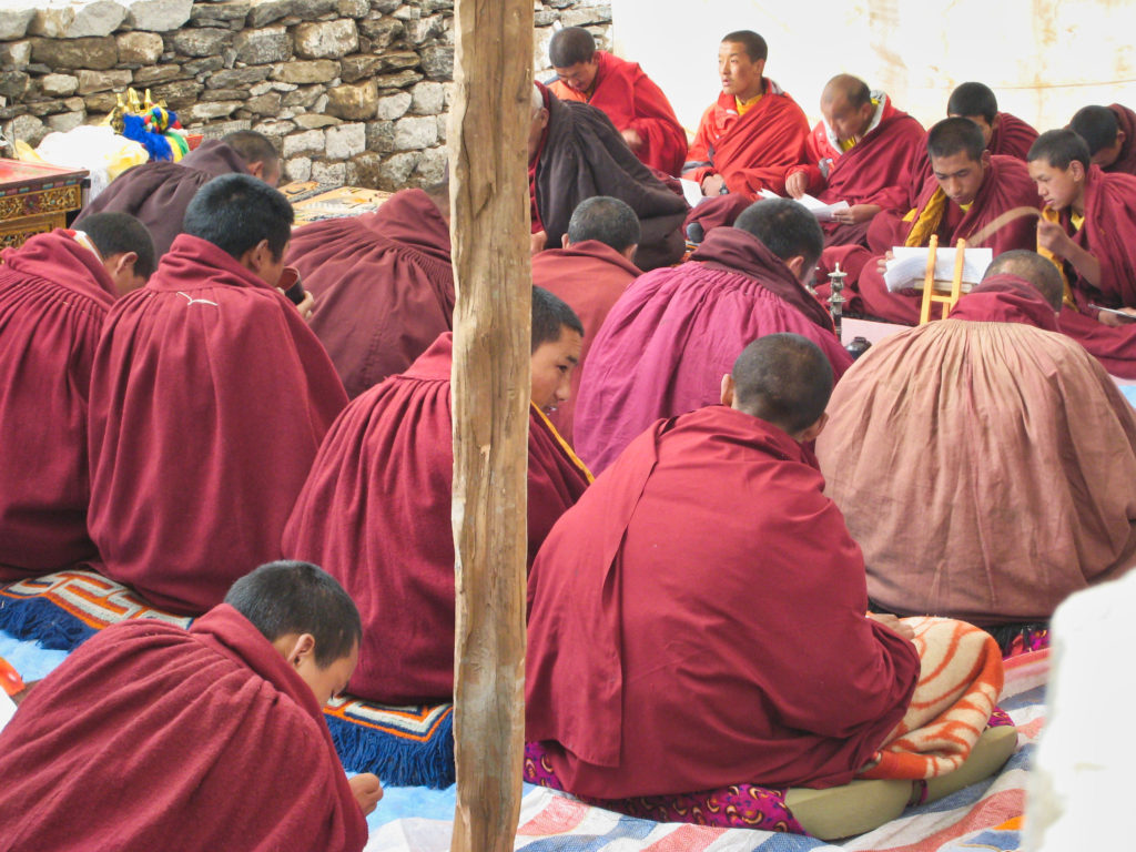
Just a few kilometres north of Namche Bazar is the village of Khumjung (2,850 m | 7,070 ft) and its infamous monastery. If you are lucky, one of the monks at the monastery will show you what is believed to be the skull of the Yeti.
The Yeti, or “Abominable Snowman” is a folkloric giant ape-man creature taller than an average human that is said to inhabit the Himalayan mountains. While the scientific community has generally regarded the Yeti as a legend, given the lack of evidence of its existence, the scull of a (or the) Yeti is held at the Khumjung monastery.
While “Yeti” is the most common name for the creature, it has other names in different regions of the Himalayas. Among the other names are the Meh-teh, Dzu-teh, the “Mirka” or “Migoi,” meaning “wild-man,” or “Michê,” meaning “man-bear”, and Kang Admi meaning “snow-man”.
After the successful ascent of Everest by Sir Edmund Hillary and Tenzing Norgay in May 1953 who reported seeing large unidentifiable footprints in the snow at high elevation, tales of the Yeti grew more popular in the West. Today, the Yeti remains a mystery!
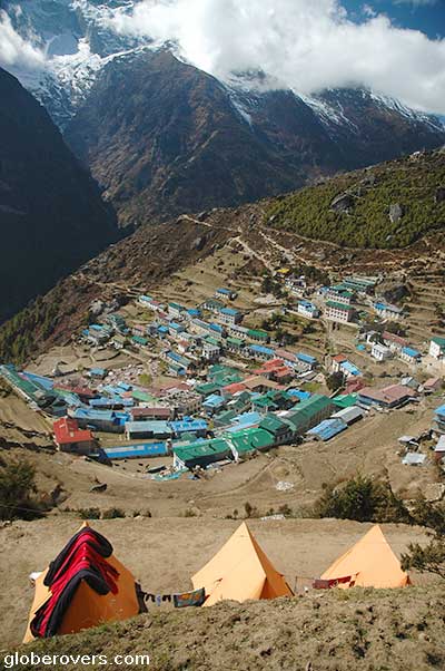
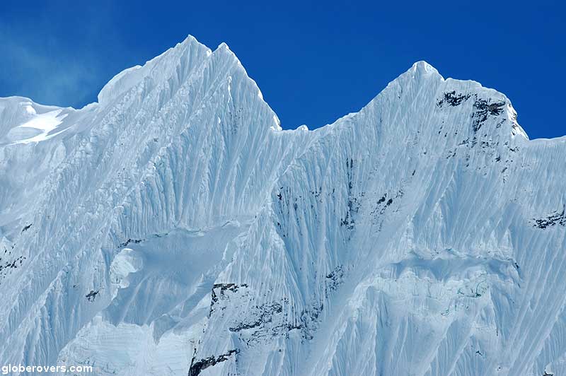
North of Kumjung the scenery gets really impressive, in particular around Dole village (4,048 m | 13,381 ft) and then all the way up to Gokyo (5,357 m | 17,575 ft).

Just south of Gokyo, which consists of just a few guesthouses, you will hike past two beautiful lakes: First Gokyo Lake 2, and close to the village is Gokyo Lake 1.
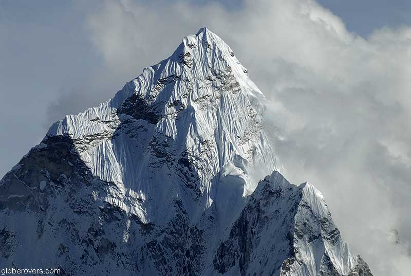
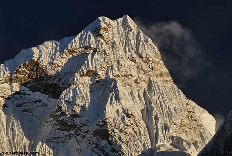
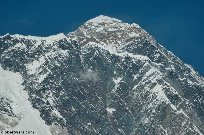
Stay at Gokyo for a few nights and climb the nearby hill (Gokyo Ri) at 4:30 AM to see the sunrise over Mount Everest (8,848 m | 29,029 ft) directly to the east. Gokyo Ri is one of the best places to see Mount Everest, so you better hope for clear weather.
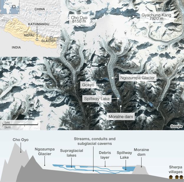
From the hill, the views are also stunning towards Cho Oyu to the north which forms the border with Tibet. Cho Oyu is the sixth-highest mountain peak in the world at 8,188 m (26,864 ft) above sea level. If you want to cross into Tibet, you need to get a few kilometres west of Cho Oyu peak to Nangpa La (5,806 m | 19,050 ft), a glaciated pass that serves as the main trading route between the Tibetans and the Khumbu’s Sherpas.
The Nangpa La pass, a foot-trail, is one of the most challenging hiking routes in the Everest region, and not recommended to casual hikers. An easier crossing from Nepal to Tibet is via the Araniko Highway (Nepal) and the China National Highway 318 (Tibet), some 70 km to the west of Gokyo.
The Nangpa La pass became world news after a shooting incident occurred on September 30, 2006, when a group of unarmed Tibetan refugees attempting to flee Tibet via the pass and were then fired upon by Chinese border guards killing at least one person and injuring many others. Some of the Tibetans safely reached India, while the rest were captured and later released. Some went “missing” while most of the captured told stories of being tortured and forced into hard labour during their captivity by the Chinese.
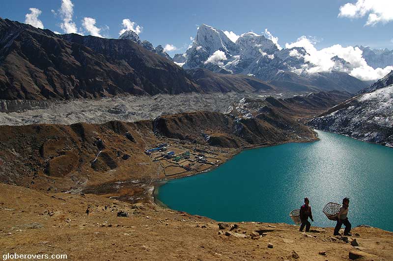
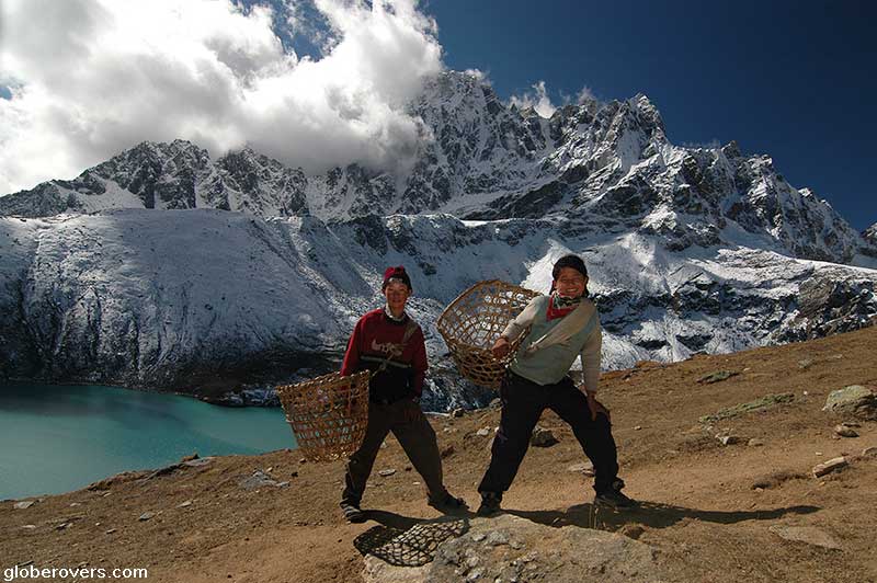
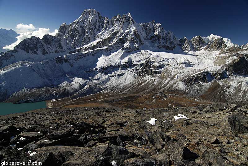
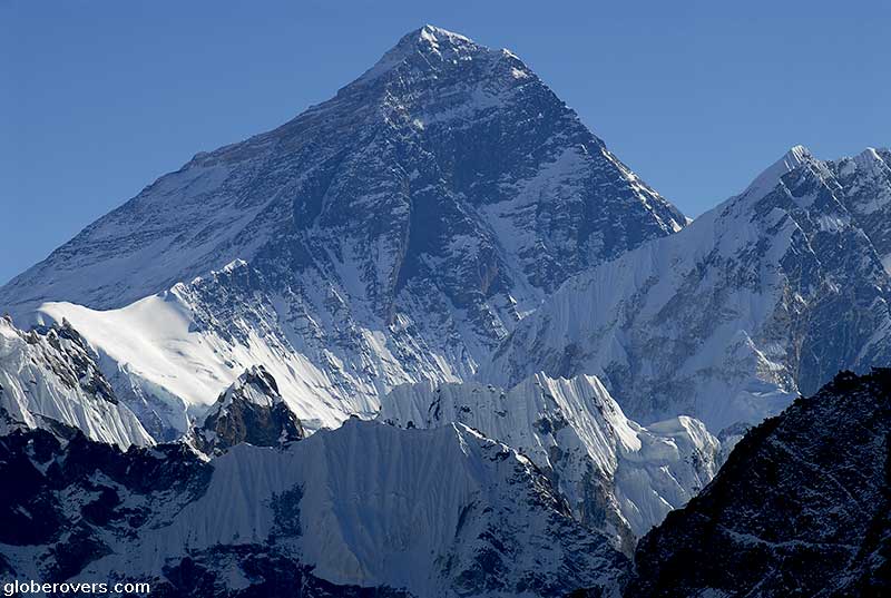
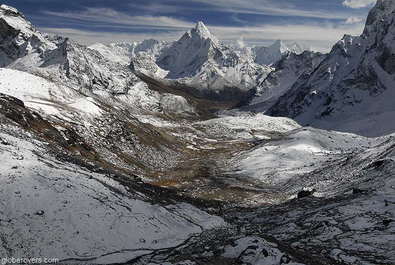
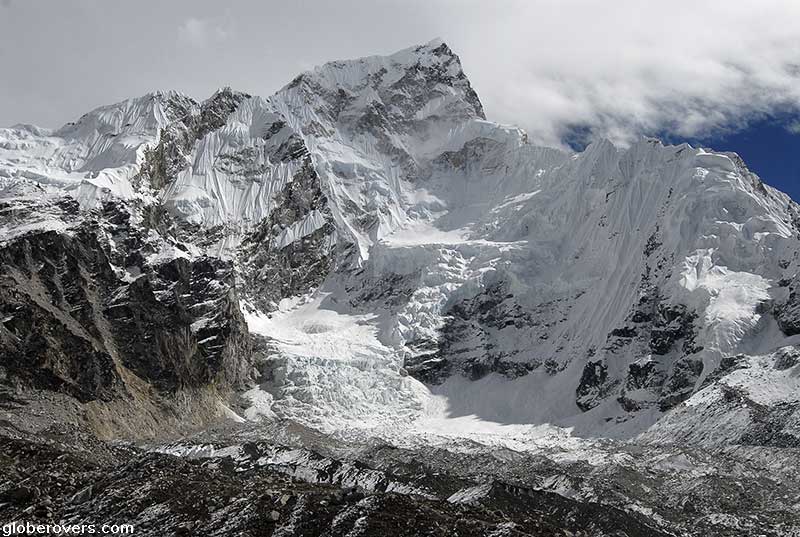
PHOTO ABOVE: Mount Everest (8,848 m | 29,029 ft) viewed from Gokyo Ri (5,483 m | 17,989 ft) near Gokyo village (5,357 m | 17,575 ft) located on the west side of the Ngozumpa glacier, which is reputed to be the largest glacier in Nepal. While it is about 5 km (3.1 mi) to Mount Everest, the view of the world’s highest peak is spectacular on clear sunny days.
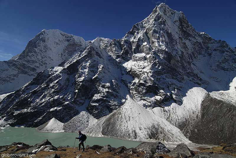
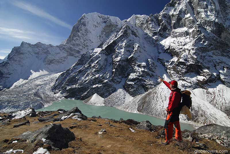
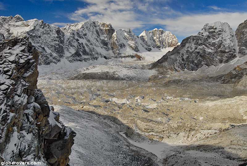
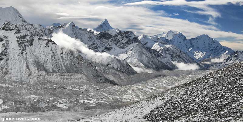
Crossing Ngozumpa Glacier and the Cho La Pass
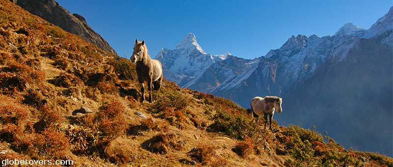
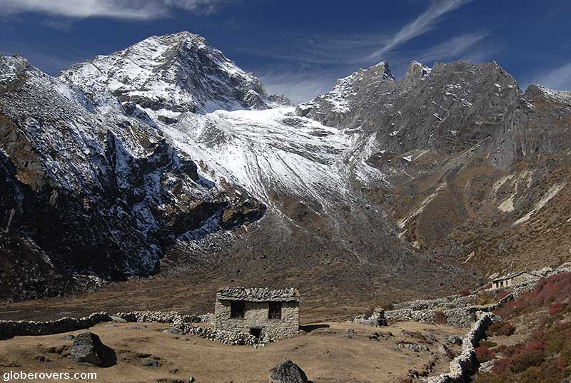
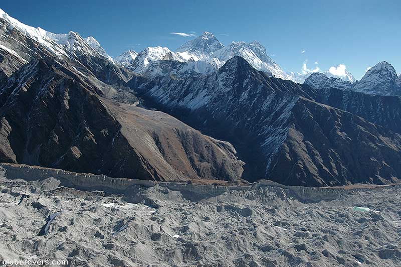
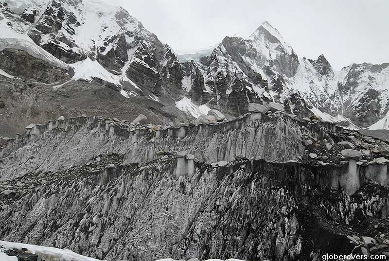
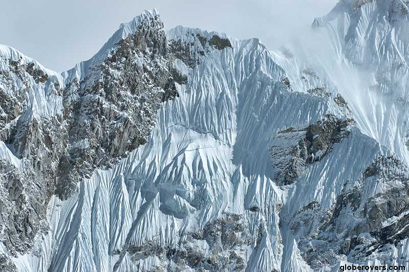
From Gokyo and the lakes around Gokyo, the path back-tracks a little south and then head over the Ngozumpa Glacier. At 36 km (22 mi), Ngozumpa is reputed to be the longest glacier in the Himalayas. The glacier flows slowly due to stresses induced by its weight.
Due to global warming, the glacier has been shrinking and thinning, producing a constant flow of running water and obvious signs of its receding over the last few decades. A large lake, called Spillway, is forming on its surface and has the potential to become quite large (6 km long, 1 km wide and 100 m deep). This will create an enormous threat to Sherpa villages further down the mountain should this great mass of water eventually breach the debris dam and hurtle down the valley.
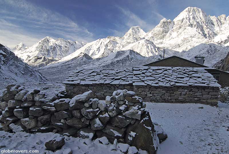
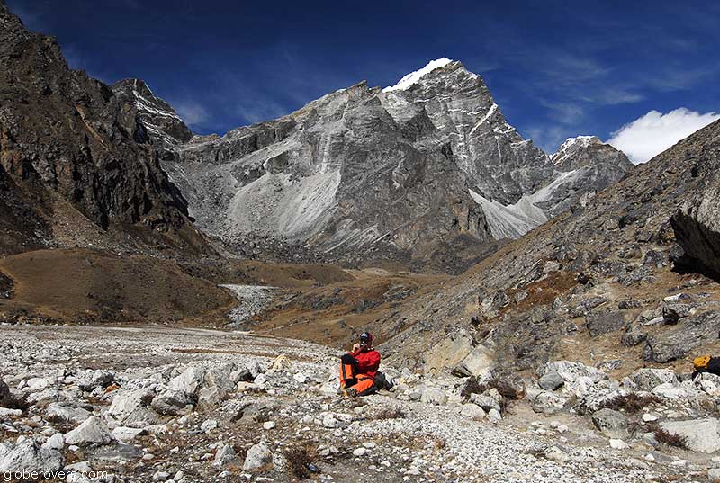
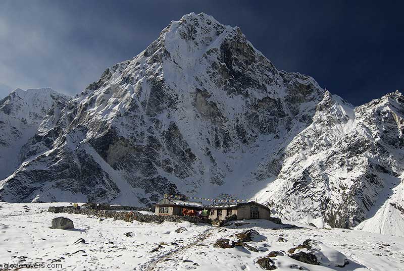
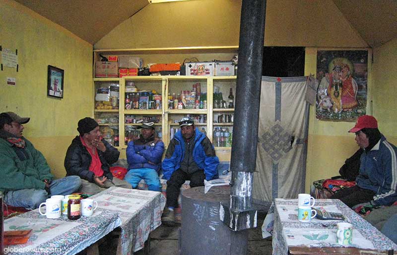
After crossing the glacier, your next stop is the village of Dragnag, also called Thagnak (4,700 m | 15,420 ft) which has a single building – your guesthouse for the night. The facilities here are dreadful as are most facilities high in the mountain. Just sleep and get out the next morning to continue the hike east.

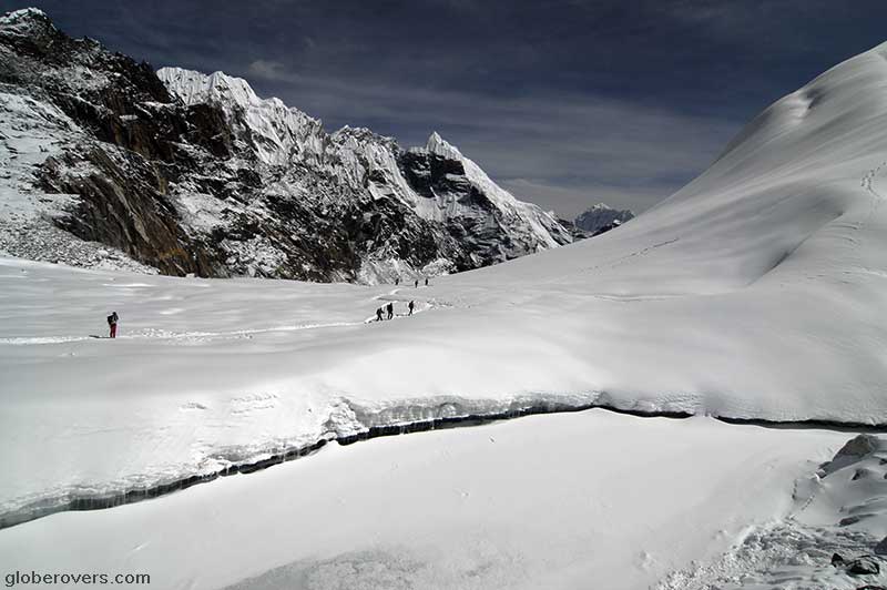
Cho La is a summit pass situated at an elevation of 5,330 m (17,487 ft). It connects the villages of Dragnag (Thagnak) and Dzongla (4,830 m | 15,850 ft). The pass can be physically very demanding, even for fit hikers, and may require crampons on top of the slippery glacier. Some sections are very steep and the terrain is made of loose rock, large boulders and ice fragments. There is not much of a path to follow, as a large section is strewn with large boulders. Hike in the right direction and just work your way around and over the boulders! Yes, it can be quite a challenge.
I was lucky to hike the pass after fresh morning snow, so while it wasn’t slippery, the few inches of fresh snow created a multitude of other challenges! It has been reported that the edges of the glacier are unstable, so be careful. Rockfall is another danger to consider, even in good weather.
There have been reports of hikers dying while crossing this pass. Some trekking websites warn that “Glacier crossings, rock falls and moraines add significant danger to treks involving ascending high passes such as Cho La pass”.
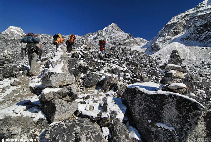
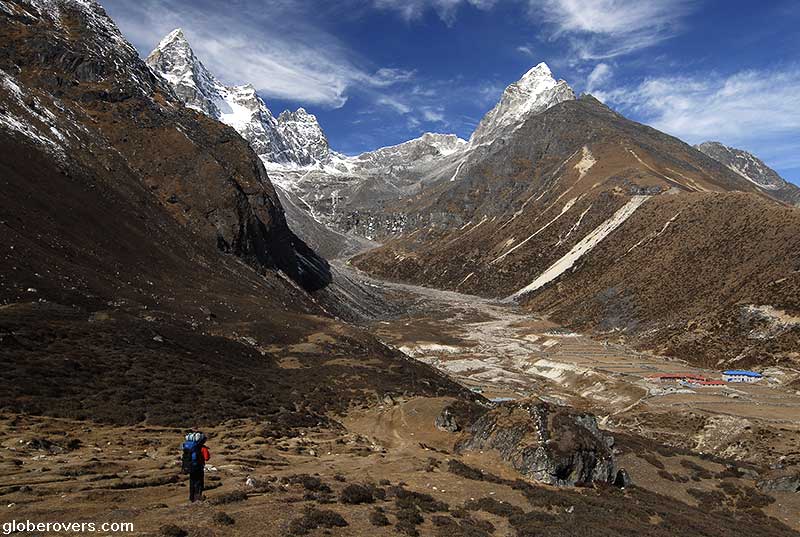
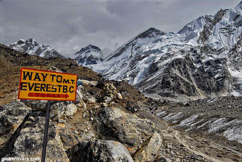
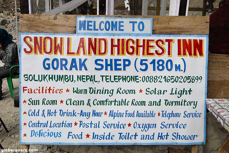
From the Cho La Pass it is non-stop stunning mountain scenery all the way down through Dzongla (4,858 m | 15,939 ft), Dughla (4,630 m | 15,190 ft) and up to Lobuche (4,830 m | 15,846 ft) where again the guesthouse facilities are very basic. Sleep again, get used to the higher altitude, and if you don’t get sick, head up further north to Gorak Shep (5,184 m | 17,008) and up to Everest Base Camp (5,363 m | 17,595). While it took you a minute to read from Gokyo to Everest Base Camp, the actual hike takes four to five days accompanied with a lot of rest-stops, photo snapping, ooo’s & aahhh’s, and a lot of physical exertion.
As stunning as the Cho La Pass may be, you will also look back at it as the “dreaded Cho La Pass”!

Arriving at Everest Base Camp
Don’t expect too much of Base Camp. Stay for a while, relax, and think of the climbers who start their ascent to Everest from here. After you pondered for a while (no views of Everest from here) head back to Gorak Shep which has a few nice hiking trails in the area, including the sunrise hike up to Kala Patthar (5,545 m | 1,8192 ft) with another great view of Mount Everest. Once again, hope for clear skies.
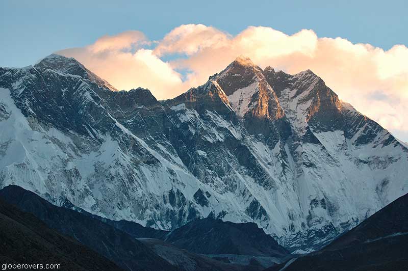
Kala Patthar – meaning “black rock”, is located on the south ridge of Pumori Mountain – meaning “the Mountain Daughter” (daughter of Everest), and lies about 10 m (33 ft) above Gorak Shep where the guesthouse is. Pumori lies just eight kilometres west of Mount Everest. As Nuptse Peak blocks out the views of Everest from the surrounding areas, Kala Patthar is the best location near the Gorak Shep guesthouse from where to get unobstructed views of Everest but also great views of Nuptse, Changtse and glimpses of the summit of Lhotse.
The world’s highest webcam, the solar powered “Mount Everest webcam” is located on Kala Patthar. The German-designed cam is run by an Italian organization and is trained on Everest’s western face. In addition to providing stunning views, it also collects data on the temperature, humidity and precipitation and can withstand temperatures as low as -30 degrees Celsius (-22 degrees Fahrenheit).
From the top of Kala Patthar peak, you may keep staring east at Mount Everest all the time, but don’t forget to look to the west, where you will spot the Changri Shar Glacier. From Kala Patthar, the views of the much longer Khumba Glacier is stunning!

(Click to enlarge)

Everest Base Camp to Namche Bazar and Lukla
Done photographing Everest? Lets head back to Lukla where the small plane will pick us up in a few days.
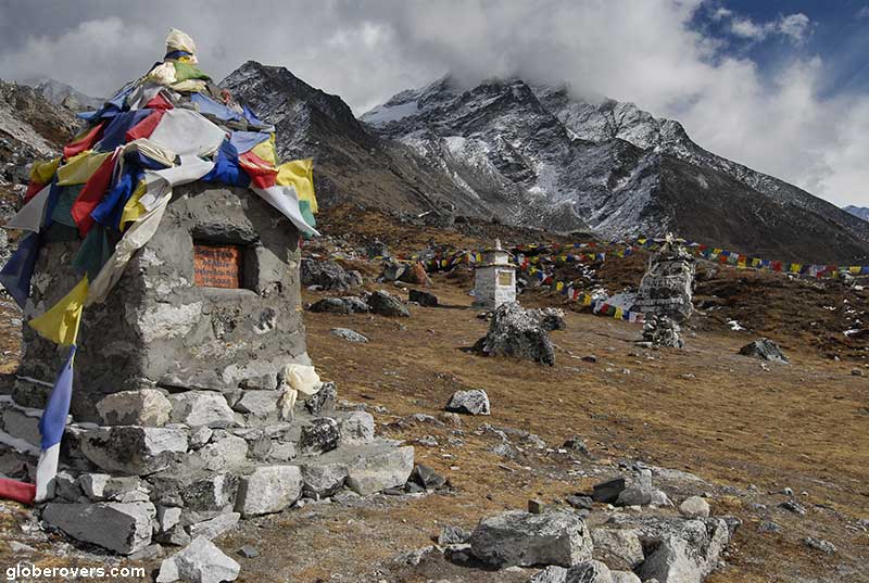
From the Gorak Shep Guesthouse head back downhill. We pass the road near Lobuche going east back to the dreadful Chola Pass. We don’t go back to the Chula Pass so we continue past Dughla and further south to Dingboche village (4,420 m | 1,4501 ft) – about 16 km south of Gorak Shep. The scenery along this route is nothing but spectacular. Local settlements are very authentic and residents are somewhat aloof.
This area has several small gravestones and shrines in memory of fallen adventurers who succumbed to the challenges of Mount Everest. One such shrine is for Dr. Sean Egan (63), a sports psychology educator and adventurer from Ottawa, Canada, who died here after suffering a cardiac arrest on Friday, April 29th 2005. He was en-route to reach the summit of Everest. His teammates took along a passport photo of him, and upon reaching the summit, they placed it in an obscure place. At the time, if Dr. Egan was to be successful in his climb, he would have been the oldest Canadian to reach the summit of Everest.

From Dingboche the path goes further south to Tengboche (3,867 m | 12,687 ft) and Pangboche (3,985 m | 13,074 feet). Don’t forget to sleep in some guesthouses along the way! Most of the villages (which are tiny communities or settlements) are very interesting with fantastic views of the surrounding mountain peaks.

This area offers brilliant views of several impressive peaks such as Everest (8,850 m | 29,035 ft), Nuptse (7,861 m | 25,790 ft), Lohtse (8,414 m | 27,605 ft), Taboche (6,367 m | 20,889 ft), and Ama Dablam (6,858 m | 22,500 ft).
Mount Everest and the many surrounding peaks are surreal
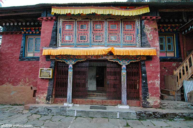
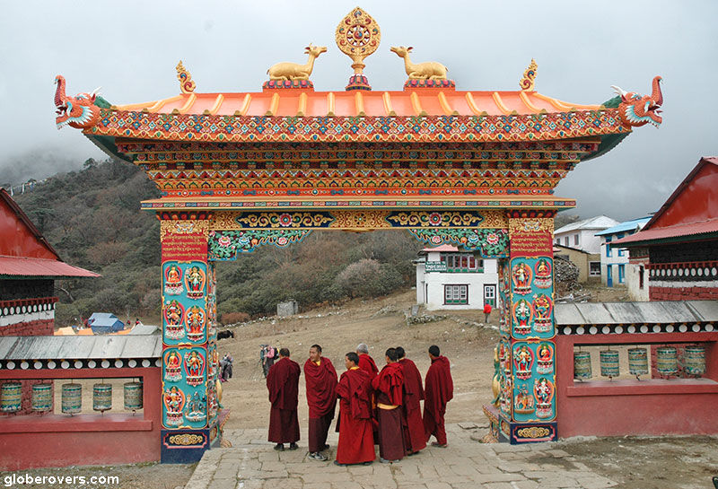
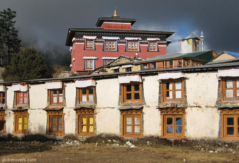
Tengboche has a particularly interesting and large monastery. The Thyangboche Monastery, also known as Dawa Choling Gompa, is situated at an elevation of 3,867 m (12,687 ft), and is the largest of its kind in the Khumbu region of Nepal. Built in 1916, it was destroyed by an earthquake in 1934. It was rebuilt but only to be destroyed by a fire in 1989. It was rebuilt once again and we trust it will remain free from another destruction.
The British singer Kate Bush, who brought us the global hit song Wuthering Heights, sings about the Tembouche monastery in her song entitled Wild Man. The 6th line in her lyrics goes as follows: ”The schoolmaster of Darjeeling said he saw you by the Tengboche Monastery. You were playing in the snow. You were banging on the doors”. The song was released in 2011 as the lead single from her tenth studio album 50 Words for Snow.

From Tengboche the scenic path descents for a few hours back into Namche Bazar. Before you arrive at Namche Bazar look back a few times to get your last glimpses of Everest, as well as some good views of the impressive Ama Dablam peak.
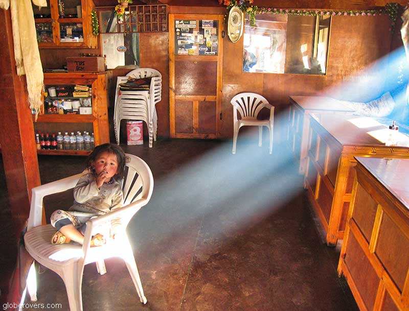
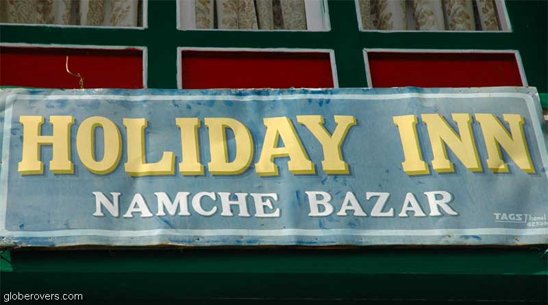
You will be happy to be back in Namche Bazar to enjoy the relative luxurious guesthouses, including the local Himalayan version of the “Holiday Inn”. This may be your first shower in the past 10 days. Enjoy it!
After a good night sleep, trace back your steps of two weeks ago and descent into the village of Lukla where your small plane is waiting for your exciting lift off from the scary airstrip.
Trust you will land safely in Kathmandu to explore the rest of Nepal.
☛ Read more: GlobeRovers’ blog posts of mountains


Further reading
- Nepal Travel Guide | Two Wandering Soles
- More Than Mountains: The Ultimate Nepal Travel Guide | Thrifty Nomads
- Kazakhstan – Almaty and the Zailiyskiy Alatau Mountains | GlobeRovers
- Morocco Adventure – Gorges south of High Atlas Mountains | GlobeRovers
- Hiking the incredible Italian Dolomites Mountains | GlobeRovers
Blog post and photos by Peter who has been travelling almost full-time since 2005 and has been to over 122 countries. He visited several countries, such as Japan, more than 20 times. Peter is Editor-in-Chief and Publisher of GlobeRovers Magazine, an independent travel magazine focused on intrepid destinations.