When we think about Pakistan, people generally have impressions of terrorism, natural disasters, poverty, and many other negative connotations. However, setting these aside, we also have visions of natural beauty, friendly people, tasty food, colourful festivals, lasting traditions, and many more.
I recently planned a trip to northern Iraq. Due to increased insurgence in the area, I decided to change direction to northern Pakistan. I figured that Pakistan was relatively safer than northern Iraq at the time. While much of Pakistan is not necessarily safe at any time, I decided to let the good triumph over the bad, so I embarked on my Pakistan excursion.

While Pakistan is a very diverse country with great natural beauty, it is the mountainous region in the north which has always captured my imagination. At the confluence of three mountain ranges: the Himalayas, the Karakoram, and the Hindu Kush, lies Pakistan’s northernmost region – the autonomous territory of Gilgit-Baltistan.
Why Travel to Pakistan’s Gilgit-Baltistan Region?
- The low-down: This region is likely the most diverse and beautiful region of Pakistan, filled with deep valleys and spectacular mountains, glaciers and lakes. It is fairly safe (2022) so just do it.
- The brightest highlight: So many highlights in this region, but if I must choose the best, then it is reaching the basecamp of Nanga Parbat (8,126 m) and spending a few days at “Fairy Meadows”. It is not the destination, but the journey to get there on an old jeep for the 12 km road trip which is listed as one of the scariest road tracks in the world. Watch my video: The Scariest Road I Have Ever Driven On.
- Intrepid destination: Oh absolutely. Much of Pakistan remains off the beaten track to foreign travellers and it is easy to escape the local tourists too.
- GlobeRovers score (10 is the highest): Great adventure around every corner so the GlobeRovers Score is 9.3 out of 10.
To the north-northwest of Gilgit-Baltistan lies a small portion of Afghanistan’s Wakhan Corridor “pan-handle”. Tajikistan is just a short hop north across the Wakhan Corridor. To the north-northeast is the wild frontier of China’s Xinjiang Uyghur Autonomous Region. The Indian-administered Jammu and Kashmir borders to the southeast, and further south are the Pakistani-administered states of Azad Jammu and Kashmir. Geographically this region is untamed, remote, and perfectly suited for the intrepid traveller!
A remote mountainous region in the far north of Pakistan known for high snow-capped peaks, glaciers, lakes, rivers and more.
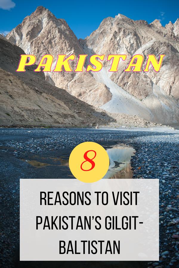
Here are 8 thrilling reasons for visiting Pakistan’s Gilgit-Baltistan Region:
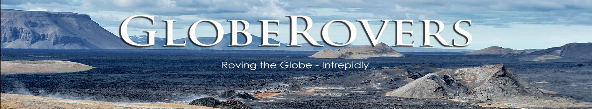
The Mountains
Gilgit-Baltistan is best known as the home of many of the world’s highest mountain peaks. Five of the “eight-thousanders” (peaks above 8,000 m) are located in the region, with another 50+ peaks above 7,000 m. The planet’s second highest peak, K2 (Mount Godwin-Austen), is located here, while the most feared peak among mountaineers, Nanga Parbat, is also in the region.
The main mountain ranges are the Karakoram and the western Himalayas. Further north along Afghanistan’s Wakhan Corridor and Tajikistan lie the Pamir Mountains, while the Hindu Kush (home of Tirich Mir Peak at 7,708 m) lies to the northwest along the Afghanistan border. Nanga Parbat (8,126 m) is in the Diamir District, while east along the western Himalayas in the Skardu District is some incredible mountain scenery.
Other high peaks are K2 (8,611 m), Broad Peak (8,051 m), the Gasherbrums (7,932 – 8,080 m), and Masherbrum (7,821 m).
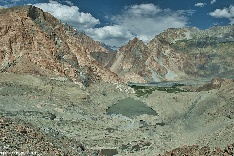
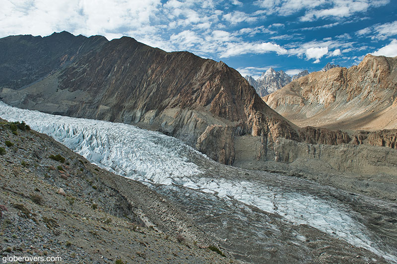
The Glaciers
In addition to the majestic snow capped peaks dotting the landscape of Gilgit-Baltistan, the region is also known for its spectacular glaciers. In fact, three of the world’s longest glaciers outside the North and South Polar regions can be found in Gilgit-Baltistan: the Biafo Glacier (67 km), the Baltoro Glacier (63 km), and the Batura Glacier (57 km). The International Centre for Integrated Mountain Development (ICIMOD) estimates that Pakistan is home to around 5,218 glaciers with a total coverage of about 15,000 sq. km.
Most of the glaciers are located in the Karakorum Mountain range with almost 37% of the area being under glacial ice.
Siachen Glacier (76 km), the world’s second longest glacier, is located in Indian-claimed territory and runs along the disputed India-Pakistan line of control in the eastern Karakoram Mountain range. The glacier’s altitude ranges from as high as 5,753 m at its head at Indira Col and down to 3,620 m in the lower reaches at the China border. The world’s third longest glacier, the Biafo Glacier, also lies in the Karakoram Mountain range. And the list goes on with many more of the world’s greatest and longest glaciers located across the region.
These glaciers are enormous sources of fresh water. The melting glaciers feed fresh water to more than 60 large and small rivers in Pakistan. As the glaciers are retreating due to climatic changes and global warming, their beauty won’t be around forever! Some conservative estimates are that these glaciers will retreat by another 40-60 metres over the next decade.
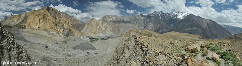
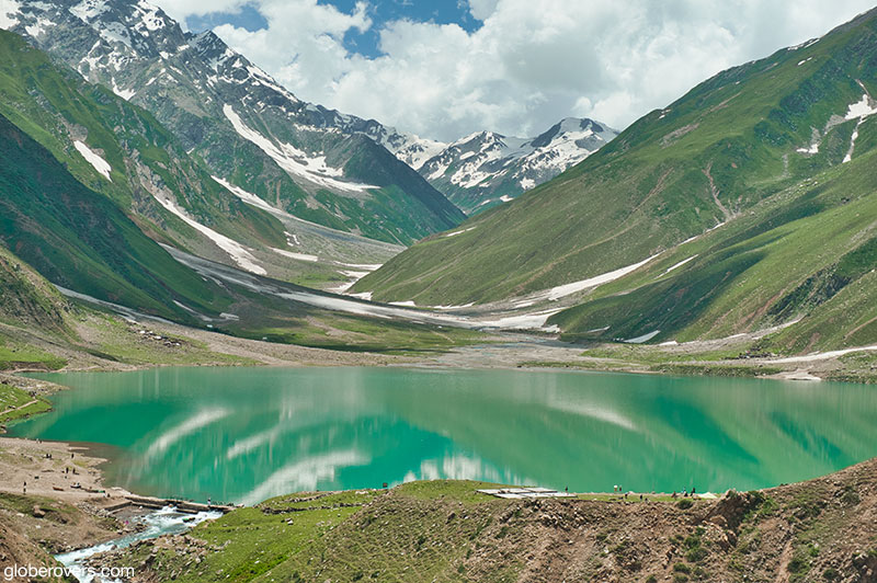
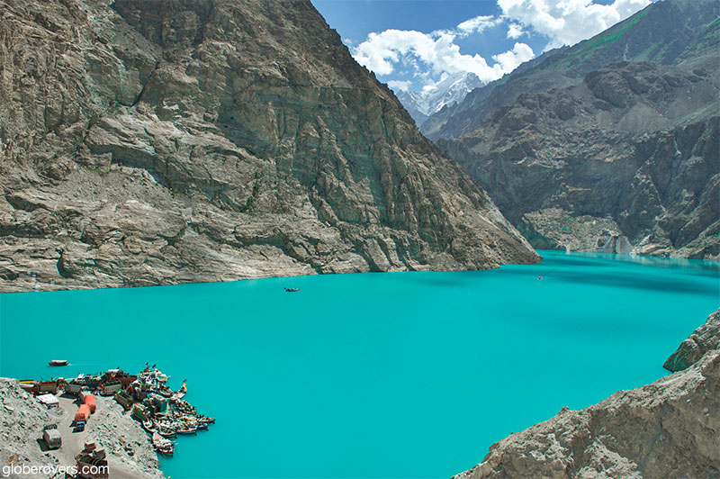
The Glacial Lakes
Looking to swim in a glacial lake? Pakistan is the place! It is estimated that Gilgit-Baltistan is home to more than 2,000 glacial lakes – many that have not been explored.
Some of the most impressive high-altitude lakes are located in the eastern Skardu area: Sheosar Lake, Satpara Tso Lake, Katzura Tso Lake, and Phoroq Tso Lake. Also, Biafo Glacier (the world’s third longest at 67 km) meets the Hispar Glacier (49 km) at the famous Snow Lake at a height of 5,128 m. This created the world’s longest glaciated highway (100 km) which stretches from Askole in the Shigar Valley all the way to Hispar in the Nagar Valley of Gilgit Baltistan.
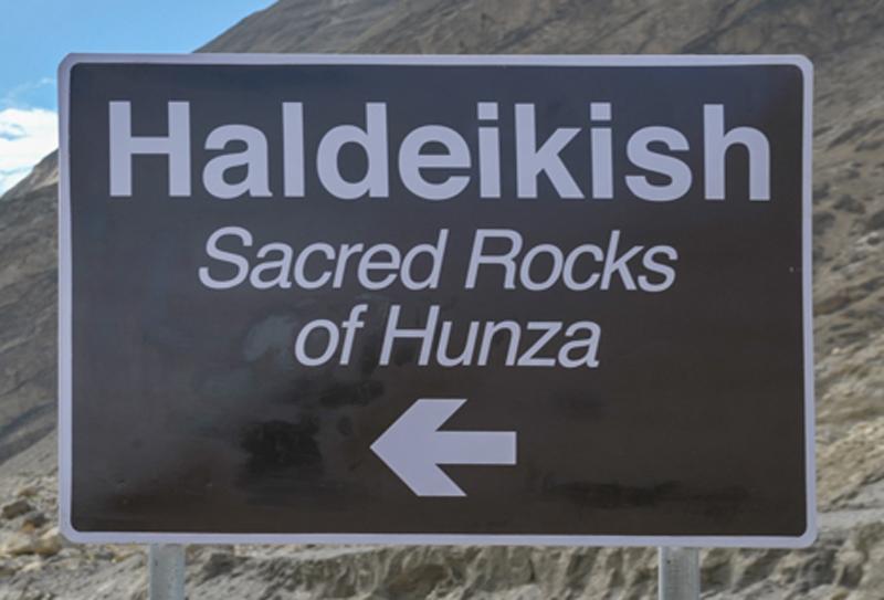
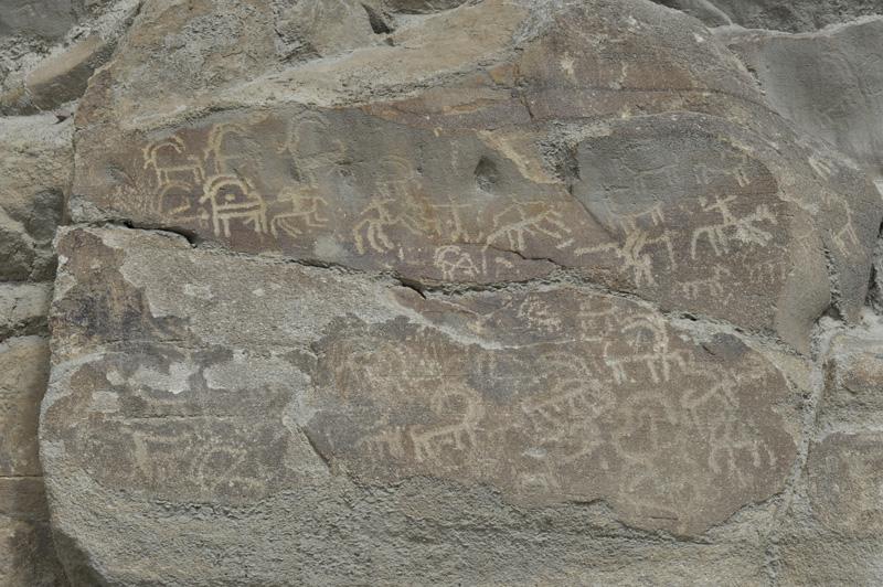
The Petroglyphs
Interested in ancient rock art and petroglyphs? Gilgit-Baltistan has it and some are very easily accessible from the famous Karakoram Highway (KKH).
Some geologists estimate that more than 50,000 pieces of petroglyphs and rock inscriptions are dotted along the KKH in the Gilgit-Baltistan region. Most are concentrated at ten major sites along the 280 km route between Shatial in the south and the Hunza Valley to the north.
Created by pilgrims, traders, invaders and locals alike, some of the earliest carvings date back to between 5000 BC and 1000 BC. Likely carved with stone tools, the carvings include drawings of humans, animals, and people hunting animals.
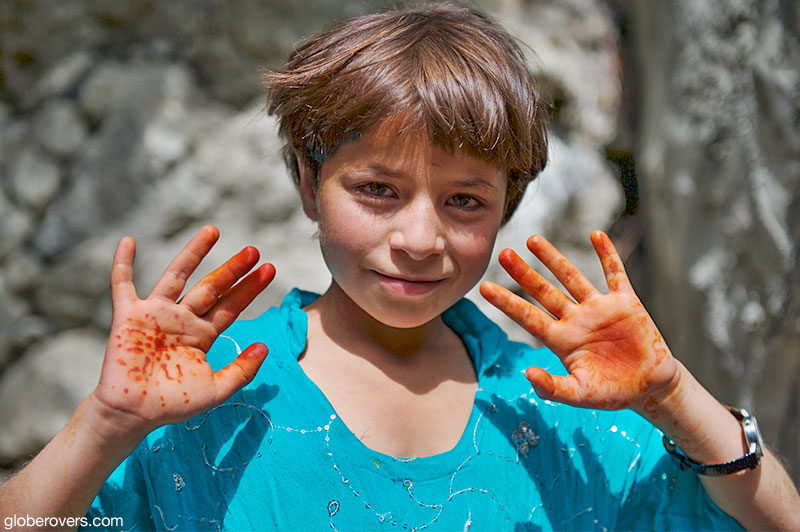
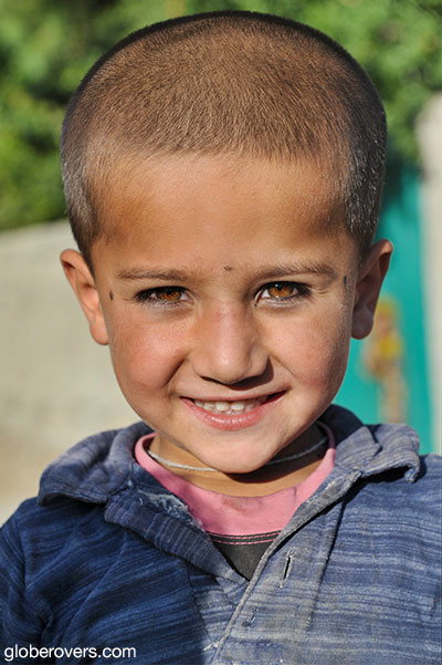
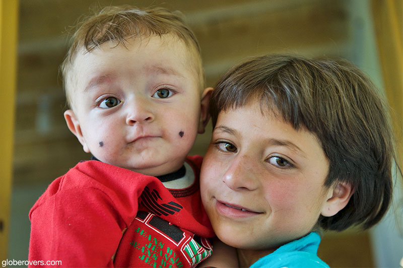
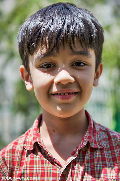
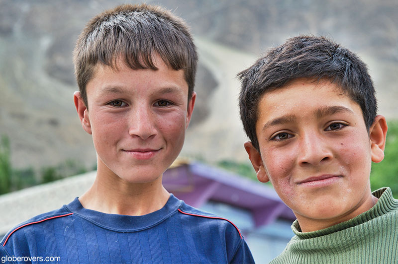
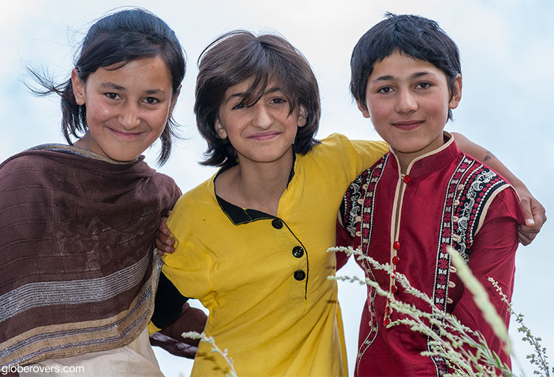
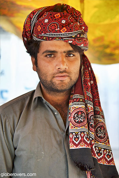
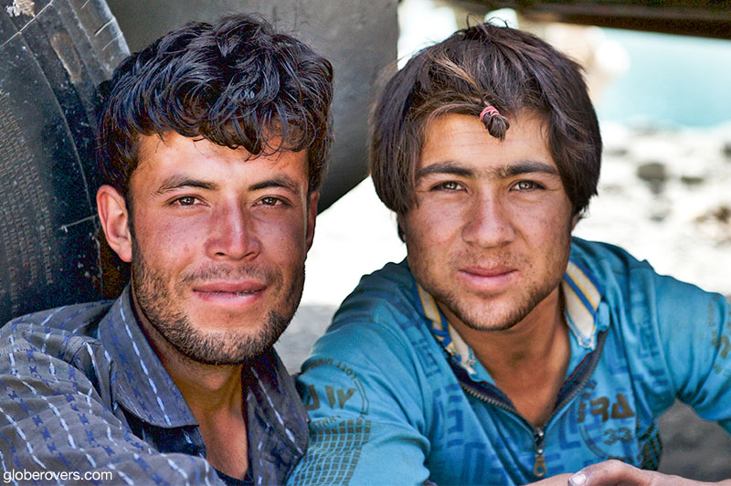
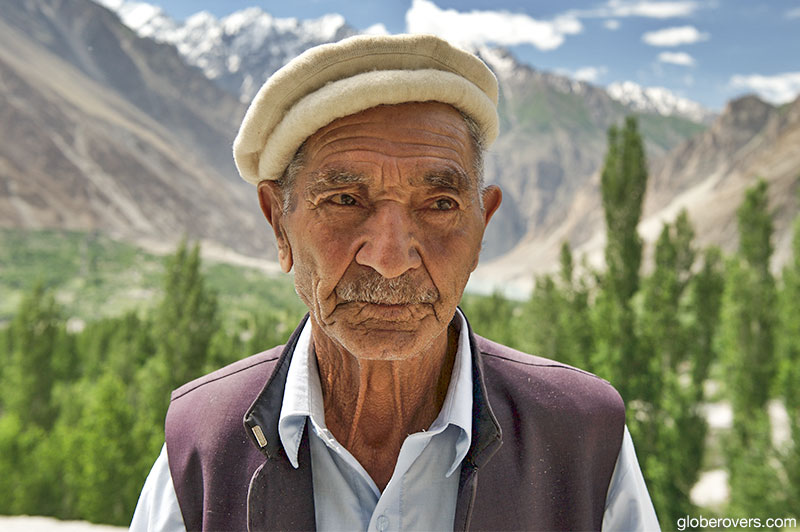
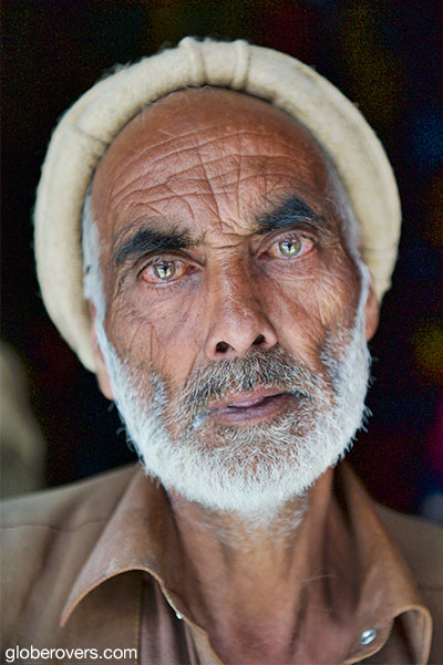
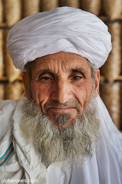
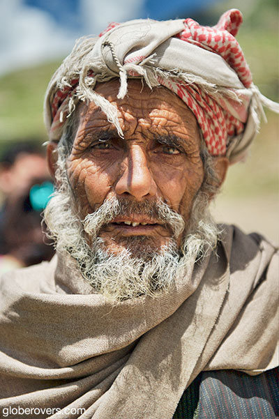
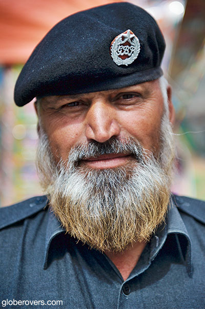
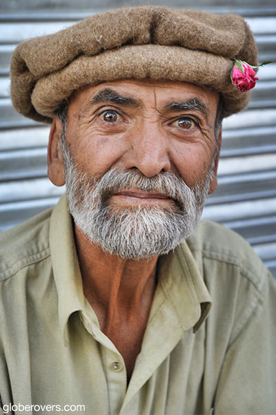
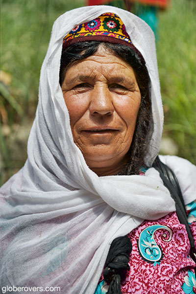
The People
The total population of the Gilgit-Baltistan region is over two million souls. Due to the historic isolation of valleys separated by inaccessible mountains, the region developed people that are very diverse linguistically, ethnically and adhering to many religious sects.
The main religious groups include the Shias (35%), Sunnies (35%), Ismailis (25%), and the Noorbakhshia (5%). The ethnic groups include the Shins, Burushos, Yashkuns, Kashmiris, Kashgaris, Pamiris, Pathans, and the Indus Kohistanis.
Most people in the region speak Urdu which is the lingua franca of the region. Other common languages are Balti, Shina, Burushaski, Khowar, Wakhi, and to a lesser extent, Punjabi, Pashto, Kashmiri Domaaki and Gojri.
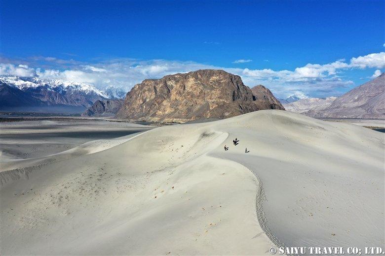
The Desert
Gilgit-Baltistan is home to the Skardu Desert which is known as the world’s highest and coldest desert where winter temperatures can dip down to -25°C. At an altitude of more than 3,000 m, few people venture into this remote area.
It has been described as “a desert surrounded by a valley that is covered with lush green vegetation where you can walk around a green paradise which suddenly meets a barren desert from where you can see the snow-capped mountain peaks towering high above miles of sand dunes”.
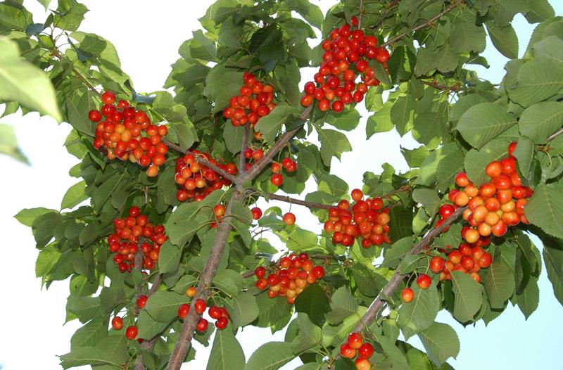
The Fruits
Gilgit-Baltistan produces about 75% of Pakistan’s apricots. Other succulent fruits grown here are cherries, apples, plums, peaches, blueberries, mulberries, honey melons and almonds. Many are sold and exported as dried.
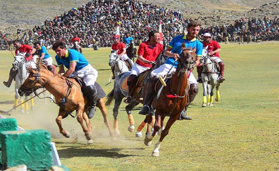
The Festivals
As polo is the most popular sport in Gilgit-Baltistan, one of the best festivals to attend is the annual three day “Polo on the Roof of the World” (also known as the “Shandur Polo Festival of Pakistan”) held during the second week of July.
The matches are played in the town of Skandur Top between the home teams of Gilgit and Chitral as well as teams from other regions. Situated at 3,719 m, it is the highest, and likely the most remote, polo grounds in the world. The polo festival also includes local folk music and dancing. Accommodation is available in a temporary camping village.
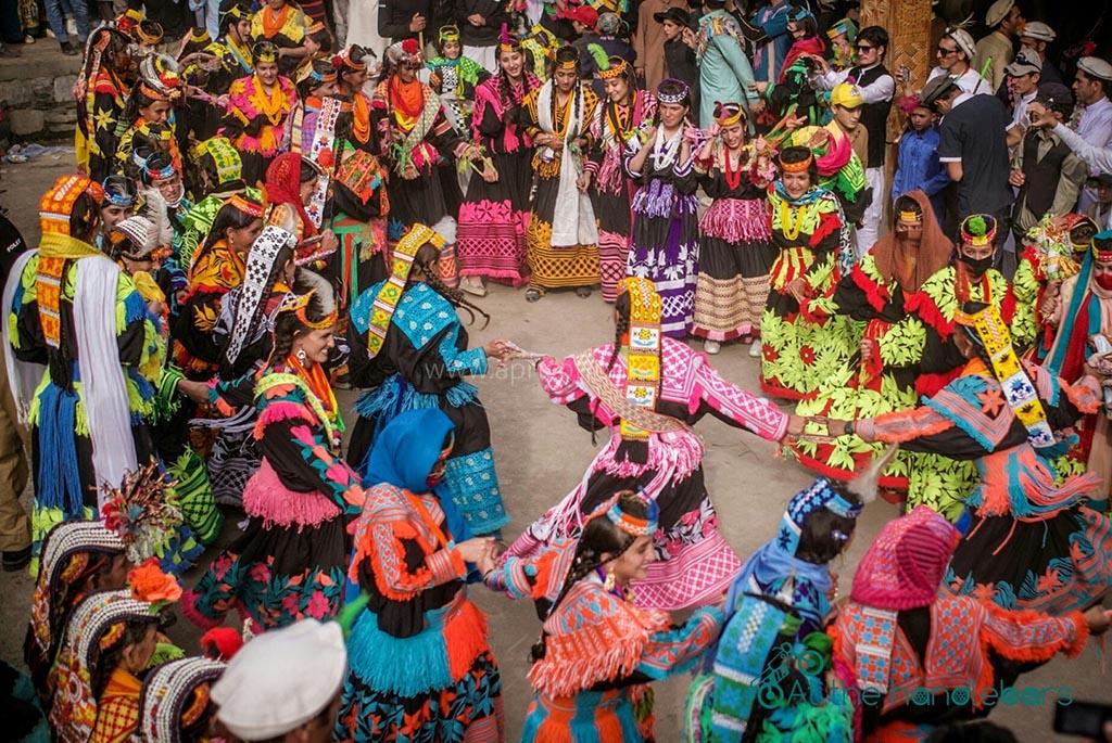
However, for those of us more interested in colourful folky festivals with an abundance of photographic opportunities, head 360 km west to the town of Chitral near the border of Afghanistan. The town of Chitral is located in the Khyber-Pakhtunkhwa province immediately west of Gilgit-Baltistan.
The Kalash people, a Dardic indigenous group of the Indo-Iranian branch, speak the Kalasha language and are adherents of Islam and their own Kalash religion. The Kalash people are known for their festivals adorned with colourfully dressed beautiful women. The four main festivals of the Kalash are the Joshi festival (May), the Phoo and Uchau festivals (autumn), and the Chawmos festival (midwinter).
☛ Read more: All posts about Pakistan
☛ Read more: Top 10 Experiences in Pakistan’s Gilgit-Baltistan


Blog post and photos by Peter who has been travelling almost full-time since 2005 and has been to over 122 countries. He visited several countries, such as Japan, more than 20 times. Peter is Editor-in-Chief and Publisher of GlobeRovers Magazine, an independent travel magazine focused on intrepid destinations.