By Marion Halliday, Adelaide, South Australia
Marion is “Red Nomad OZ”, author, blogger and Aussie traveller who loves discovering nature-based attractions and activities – and scenic loos – all over Australia. Her Aussie travel blog and published book “Aussie Loos with Views” provide inspiration for other Aussie explorers.
Getting to Australia’s Cameron Corner can be tricky. Long stretches of all roads leading to this remote Outback junction in the heart of “Corner Country” are rugged; rocky enough to shred your tyres, or sandy enough to get bogged; and dusty when dry, which is most of the time.
If it does rain, that doesn’t change anything for the better—the roads are either a quagmire; or closed altogether. And other hazards along the way like clay pans, bull dust, stray wildlife, minimal facilities, and the ‘experimental’ driving techniques of some other road users are just standard for road-tripping the Outback.
Exploring the Aussie Outback with Red Nomad OZ!
But for me, those difficulties were a small price to pay for the chance to see a quirky part of Australia —the only place in Australia where the straight lines of three state boundaries meet to make a corner. Exploring the countryside around Cameron Corner (yes, it’s called “Corner Country”) with its intriguing history and stunning outback scenery was a drawcard too.
Section 1: Adelaide to Broken Hill
It’s an uneventful 500 kilometre (320 mile) drive north on the Barrier Highway from Adelaide to Broken Hill, crossing the state border at Cockburn, about 50 kilometres (30 miles) south of Broken Hill. It’s not known as the “accessible Outback” for nothing—the fully sealed bitumen road is a big advantage of this section of the route! Our Subaru Forester copes with most dirt roads but doesn’t have very high clearance, so we didn’t want to test its off-road capabilities in the middle of nowhere.
Heavy rain on our first night in Broken Hill, also known as the “Silver City”, delayed the second leg of the trip, as the dirt roads further north were impassable. And that was a silver lining right there! Named for its legendary hill made up of rich deposits of lead, zinc and silver, Broken Hill is surrounded by natural attractions, has a rich mining heritage, and is a great place to explore.

Town highlights here include the world’s biggest park bench atop the slag heap in the middle of town—the Line of Lode lookout and a memorial to over 800 miners who have died in the mines to date are up there as well. The Geo Centre, Silver City Mint, Art Galleries and “The Big Picture”, largest acrylic painting on canvas in the world, showcase regional attractions and artists. Most famous is “Pro” Hart, a one-time miner whose quirky scenes of life in the Outback shot him to worldwide fame.
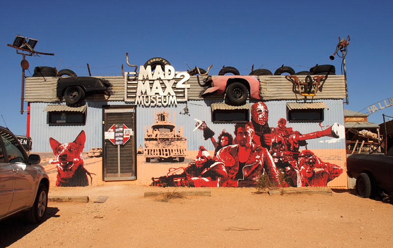
Near Broken Hill, the town of Silverton is gateway to the desolate Mundi Mundi Plain, and home to the Mad Max 2 Museum. They are just two reminders of the many movies such as “Mad Max 2” and “Priscilla, Queen of the Desert” shot in and around the town over the years.
Just out of town, The Living Desert State Park’s hiking trails highlight the superb outback scenery, but the smart travellers and photographers (or in my case, both!) head straight to the Sculptures. Carved into Broken Hill’s sandstone by sculptors from around the world in 1993, it is standing room only at sunset for that killer shot of the sun’s rays shining through a hole in one of the sculptures.
Section 2: Broken Hill to Tibooburra
It’s 330 kilometres (205 miles) north on the Silver City Highway from Broken Hill to Tibooburra, often the hottest place in New South Wales (although not during the Aussie winter when we travelled).
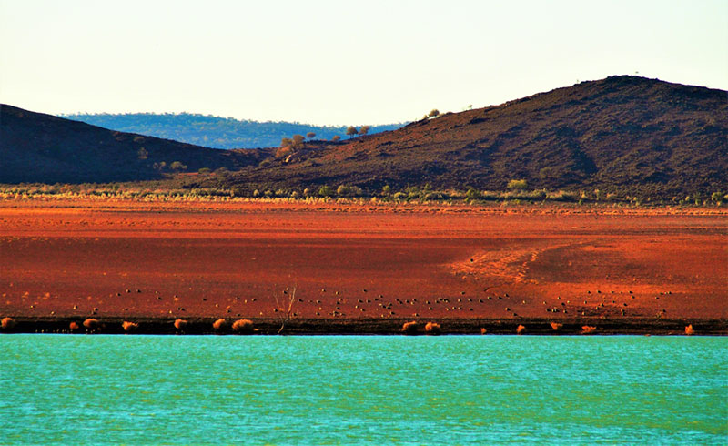
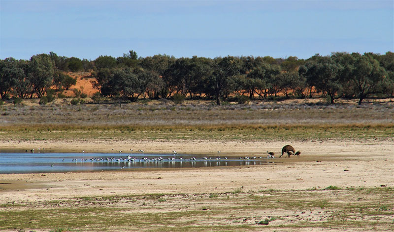
Before it was fully sealed, dirt (or mud!) made driving the road an adventure. Even though it is now sealed, look out for wandering wildlife and stray semi-trailers. We took a welcome half-way pit stop at Packsaddle, a roadhouse with benefits like food, accommodation and showers—the perfect place (actually, the only place) to stay if rain closes the roads. A little further on, we were lucky to see water in Cobham Lake, a drawcard for birds and animals.
Tibooburra is named from an Aboriginal word meaning “heap of rocks”, and it’s impossible to avoid them around town, in the (mostly dry) riverbeds, and on the roads where a puncture is almost inevitable.
There’s a whole mountain of rock and a plain of white gibbers on the 110 kilometre (66 mile) loop drive from Tibooburra. You will pass the partially restored historic Milparinka township, Mount Poole and Depot Glen, the only permanent waterhole in the district where explorer Captain Charles Sturt’s expedition stayed for about six months awaiting rain when they ran out of water. Nothing much to do except build towers of rock out here!
Once again, the next leg of our trip was delayed when four millimetres (0.16 inches) of rain fell overnight, enough to close all roads into and out of Tibooburra. But those silver linings struck again as we got to explore the town. Along with the rock formations and sunset lookout, is a self-guided historic walk, museum and pioneer park with a replica of the boat Sturt’s expedition brought with them to sail the inland sea they expected to find.
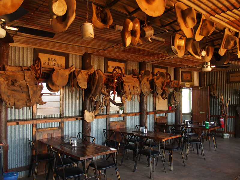
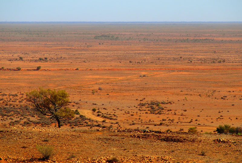
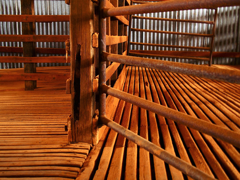
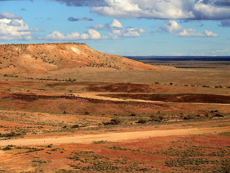
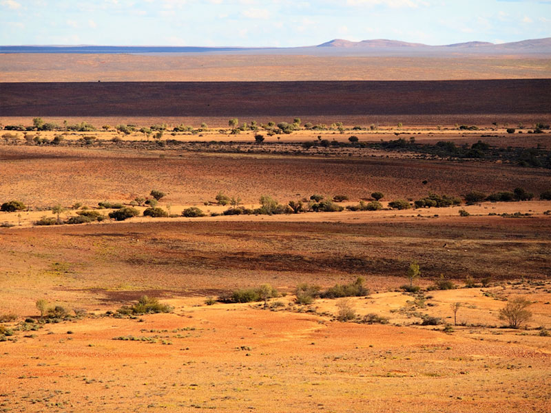
Over the years, the 340,000 hectares (1,313 square miles) of Sturt National Park’s semi-desert country has been Aboriginal traditional lands, a gold mining area and a pastoral lease. With a suitable vehicle, the park’s three self-drive loop trails are a fascinating cross-section of the region’s natural and historic attractions—especially the old woolshed, outbuildings and machinery close to the homestead, and the spectacular land formations and outback scenery further afield.
Section 3: Tibooburra to Cameron Corner
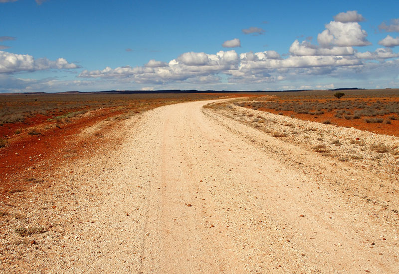
The next day dawned bright and clear, and all roads out of town were open. Even so, we checked road conditions with the local experts who told us the Cameron Corner route was good to go. It’s only a 140 kilometre (86 mile) drive north-west from Tibooburra, but with rocky outcrops, sand dunes, dust (yes, even after rain!), mud puddles, pot holes, wildlife wanderings, and, of course, other vehicles, the trip can take longer than expected. Admiring the freshly-washed colours contrasting with the bright blue sky, we made good time as the road wound through superb outback scenery.
Then suddenly the road stopped.
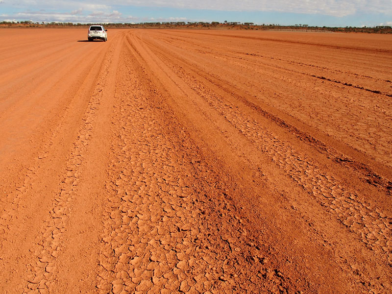
In front of us extended a vast expanse of clay gently cracking in the sunshine – the Waka Claypan, recovering from the rains two nights before. Not just a claypan though, it’s also a stretch of the road! And that, my friends, is why you must always ask about road conditions before you set out—the day before we would have been bogged before we even saw the claypan.
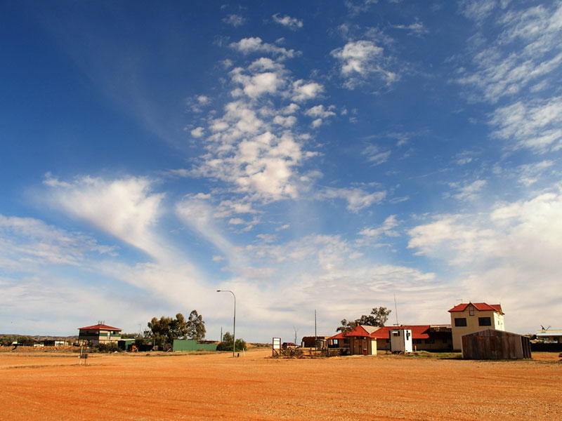
Finally, we reached the state border between New South Wales and South Australia, marked by the Dingo Fence. At 5,614 kilometres (3,488 miles) in length, it’s the longest man-made structure on earth. Being sure to close the gate behind us—there are harsh penalties for leaving it open—we drove on into Queensland and the Cameron Corner roadhouse.
Near the roadhouse, a survey marker shows the exact junction of New South Wales, Queensland and South Australia. We had reached Cameron Corner and could stand in three states at once!
After almost non-existent traffic on the road from Tibooburra, the multiple red-dirt-covered 4WD vehicles in the parking bays were a reminder we were back on the tourist trail. Unlike us, many other travellers had arrived at Cameron Corner en route to or from Queensland, or as a detour from South Australia’s iconic Strzelecki Track. These other routes involve a whole lot more dirt (or mud!) roads and rugged road surfaces than we’d been on so far.
But that was all about to change.
After exploring the Cameron Corner attractions—campground and accommodation; the tri-state nine-hole golf course (three holes in each state); the junction marker post; scenic loo; and lunch inside the roadhouse—it was time to return to Tibooburra.
After casting an expert eye over our vehicle, one of the roadhouse staff suggested we return to Tibooburra via Middle and Jump Up Loop roads, two rugged 4WD-only tracks through the western section of Sturt National Park, about the same distance as the way we had come. On this route, we saw no other vehicles as we drove one of the roughest roads we’d encountered through some of the most remote, desolate, varied and wildly spectacular Outback scenery we’d ever seen.
The Middle Road twisted its sometimes tortuous way through a drowned Coolibah tree forest, ephemeral swamps, dunes, homestead and stockyard ruins, vast plains, creek beds and low ranges before joining up with the Jump Up Loop Road. From here, the scenery became much more dramatic as the road followed the top of a series of flat-topped mountains (sometimes called “jump-ups” in Australia) before plunging down through eroded rock layers into the extensive gibber plains below.
We got back to Tiboburra 280 kilometres (172 miles) and about eight hours after setting out that morning. After a long, hard day on the road, our most difficult decision was choosing which of the two pubs in which to dine that night.
Tomorrow we faced the return trip to Broken Hill and Adelaide, but for now, our Corner Country Odyssey was over.

FOLLOW MARION HALLIDAY:
Marion blogs as “Australia by Red Nomad OZ” at www.redzaustralia.com.
▷
Follow Marion @rednomadoz on Twitter, Pinterest, LinkedIn, and Flickr. Facebook: RedzAustralia.
▷
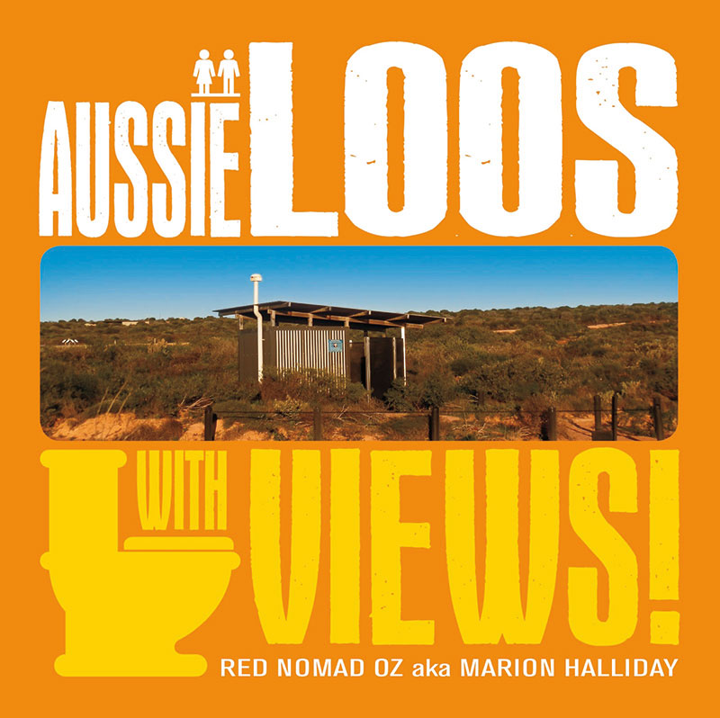
Buy her book: “Aussie Loos with Views!” at Amazon.com and eBay.com.
☛ Read more: Posts by Marion Halliday, the Red Nomad Oz


Marion is “Red Nomad OZ”, author, blogger and Aussie traveller who loves discovering nature-based attractions and activities – and scenic loos – all over Australia. Her Aussie travel blog and published book “Aussie Loos with Views” provide inspiration for other Aussie explorers.